1:00 PM | *Great Lakes snow machine is running at full force...Buffalo with 4 feet of snow and counting...coldest November day across the CONUS since 1976*
Paul Dorian
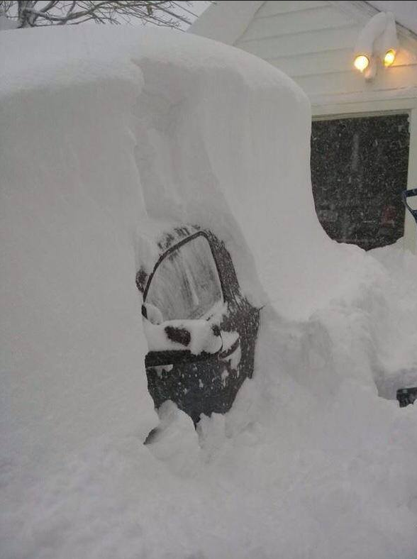 [Buffalo snow as of this morning]
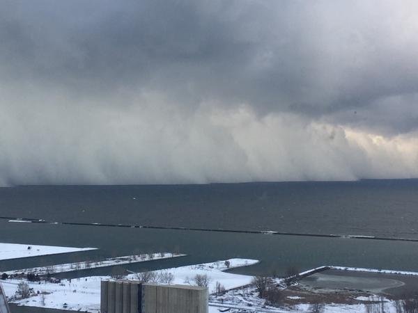 [Looking south over Lake Erie with walls of snow headed towards Buffalo]
Discussion
Great Lakes snow machine Talk about a perfect setup…the combination of southwesterly winds in the lower atmosphere, brutal cold Arctic air for mid-November and relatively warm Lake Erie water temperatures is producing incredible snow amounts in areas just to the south of Buffalo with 4 feet on the ground and several more feet possible over the next day or two. This setup is perfect for Buffalo to get pounded with snow as southwest winds in the lower atmosphere allow the air to flow for the longest period of time over the longest possible path across Lake Erie which is oriented southwest-to-northeast. As this air flows over Lake Erie, it picks up tons of moisture and dumps it on southwestern New York. This same type of pattern is occurring downwind of Lake Ontario in upstate New York and several feet of snow is expected just to the south of Watertown, NY as well.
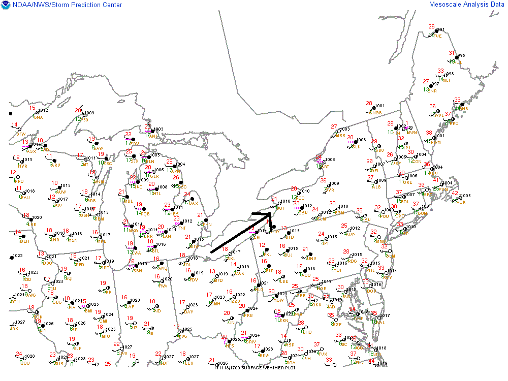 [Surface map showing southwest winds over Lake Erie which is perfect setup for Buffalo; courtesy NOAA]
Historic Arctic blast As a whole this morning, the continental US experienced its coldest average temperature in the month of November since 1976. According to Weather Bell Analytics (weatherbell.com), the average temperature across the CONUS bottomed out earlier today at 19.4°F when more than 85% of the surface area reached or fell below freezing. All 50-states saw at or below freezing temperatures on Tuesday and should again on Wednesday. Numerous cold temperature records are likely to be broken on Wednesday from the Northeast US to the Deep South as this Arctic blast becomes well-entrenched in that part of the country.
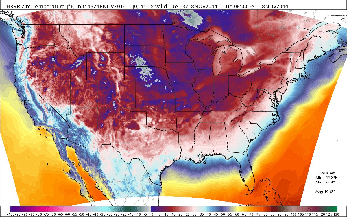 [Coldest November day across the nation since 1976; map and data courtesy Weather Bell Analytics]
Looking ahead Milder weather is in sight. It looks like it’ll turn milder on Sunday and Monday; however, that warm up is likely to be accompanied by some more rainfall.