12:30 PM | *Snow threat for late in the week as winter-like pattern resumes following our "spring break"*
Paul Dorian
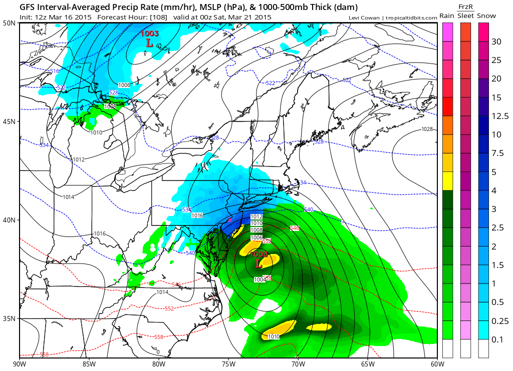 [12Z GFS model forecast map for Friday evening with snow (blue) in much of the I-95 corridor; map courtesy "tropicaltidbits.com", NOAA]
Discussion
Overview Our “spring break” period is about to end and a colder-than-normal weather pattern will resume on Wednesday, March 18th, and it looks like it will continue through the remainder of March and into the first part of April. In addition to the change back to the colder-than-normal temperatures, there is the threat for snow late this week as moisture in the southern states, and developing low pressure near the coast, collide with cold air in the I-95 corridor.
Details After a mild day to start the week, Tuesday will feature a strong cold frontal passage in the Mid-Atlantic region. While tomorrow can still be on the mild side, the winds will pick up noticeably and these winds will signal big changes in the offing for Wednesday (and beyond). In fact, temperatures are likely to drop into the 20’s later tomorrow night and struggle to pass 40 degrees on Wednesday in much of the Mid-Atlantic region. Moisture from the southern states will advance northward on Thursday and low pressure will begin to organize near the coast. By later Thursday night and Friday, with cold air in place in the I-95 corridor, it is indeed possible for snow to break out across DC, Philly and NYC as we head into the last day of the work week. The latest (12Z) GFS model forecast map for Friday evening depicts a pretty widespread area of snow (blue) throughout much of the I-95 corridor with low pressure off the coastline. Stay tuned.