2:50 PM | Strong-to-severe thunderstorm threat for tonight
Paul Dorian
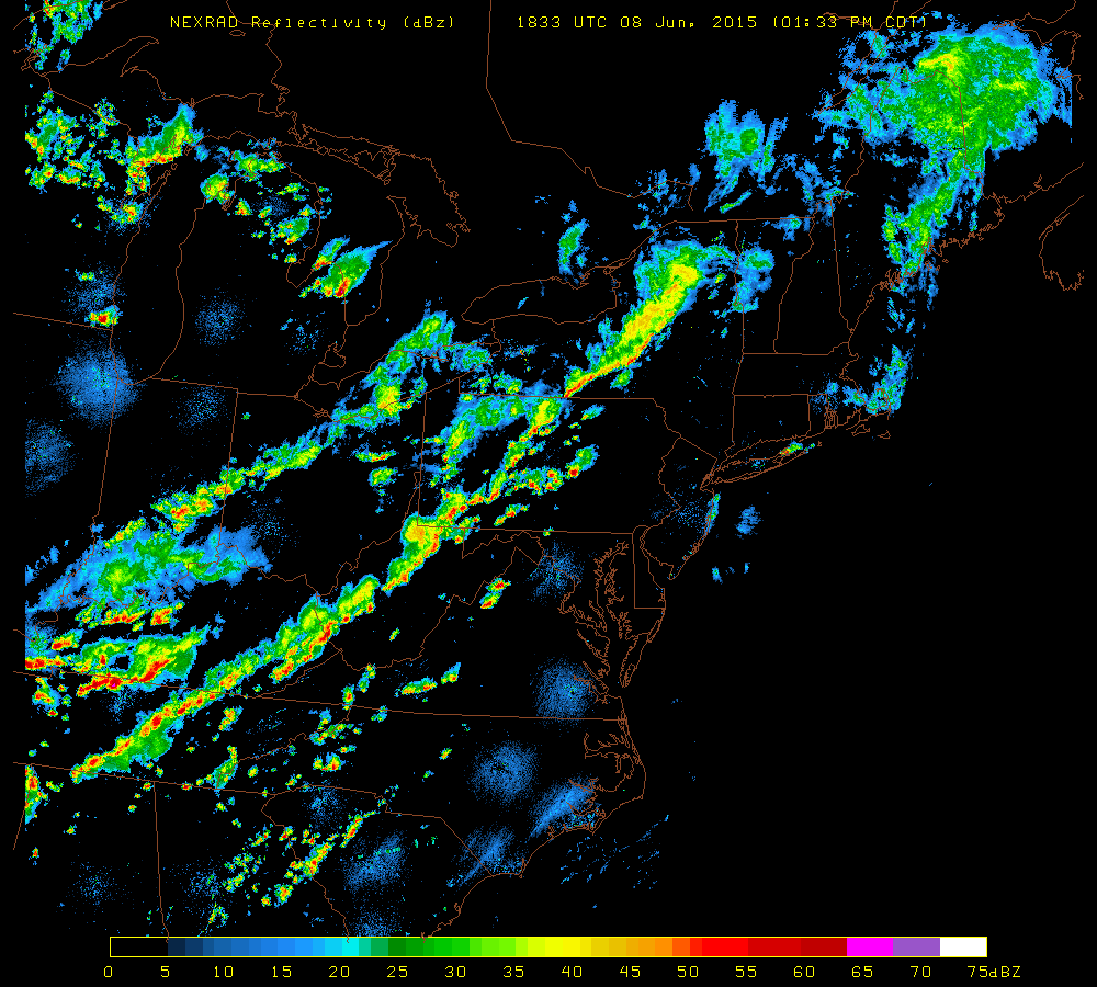 [NEXRAD radar image at 2:33 PM; courtesy University of Wisconsin]
Discussion
The combination of an approaching cold front, building heat and humidity, and an upper-level wave of energy is sparking the formation of strong-to-severe thunderstorms in much of western portions of the Mid-Atlantic region. Latest radar (above) shows an impressive line of thunderstorms from central Pennsylvania to West Virginia in a pre-frontal trough of low pressure. Skies have partially cleared along the I-95 corridor from the morning low cloud deck and this has allowed for afternoon de-stabilization of the atmosphere with increasing low-level heating. The National Weather Service has not put out any watches or warnings for the immediate I-95 corridor; however, they have issued “tornado watches” for areas just to the west of the big cities. NWS “watches/warnings” are likely to be issued later today for the I-95 corridor from DC-to-Philly-to-NYC. Any thunderstorm this evening can contain damaging wind gusts, brief downpours, hail and perhaps even an isolated tornado with the expected timetable of ~6pm to midnight.