12:15 PM | The first hurricane of the Atlantic tropical season...likely headed towards Puerto Rico and Hispaniola...may reach its peak intensity during next 24 hours or so and then weaken
Paul Dorian

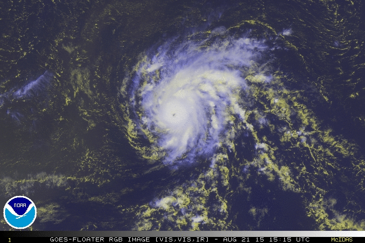
[Latest GOES satellite image of Hurricane Danny; courtesy NOAA/McIdas]
Friday 12:15 PM Discussion
Danny has become the first hurricane of the Atlantic Ocean tropical season and it has reached a strong category 2 status with sustained winds of 105 mph while moving WNW at 10 mph. This system started off earlier in the week as an “African-wave” moving from the east to the west pushed along by tropical trade winds. Danny strengthened noticeably in the overnight hours and its rather small eye has become better defined (see satellite image above).
While strengthening can continue over the next 24 hours or so – perhaps even allowing Danny to reach major hurricane category 3 status – there are signs that after that point in time some weakening is likely to take place. Currently, there is a weak trough over the western Atlantic and this should lift northward over the next couple of days allowing for a ridge to build westward and strengthen. As a result, Danny is likely to turn more westward in the near term and perhaps experience an increase in its forward speed. The current environment for Danny is that of light vertical wind shear, but as the ridge intensifies, there is likely to be increasing upper-level southwesterly flow and the overall vertical wind shear should increase after 24 hours or so. [Vertical wind shear can be defined as a change of wind direction with altitude where strong wind shear indicates significant wind direction changes in a given vertical column of air].
In addition, Danny is about to encounter an area of dry air which should inhibit its intensification along with the increasing vertical wind shear which is aided in part by El Nino conditions in the tropical Pacific Ocean. In fact, dry air from the Saharan Desert region of Africa extends all the way from the African coast to the Caribbean Sea. Danny, as indicated below by the arrow, is about to move into an area of drier air that originated over the Saharan Desert (dry Saharan air indicated by "yellows/oranges").

[Saharan air analysis; courtesy NOAA/CIMSS-University of Wisconsin]
Danny is expected to reach the Leeward Islands in about 3 days (Monday), near Puerto Rico in about 4 days (Tuesday) and then near the island of Hispaniola (Haiti/Dominican Republic) in about 5 days (Wednesday). Given the likely increase in vertical wind shear and its encounter with drier air, Danny may very well drop back to "weak hurricane" or even “tropical storm” status by the time it reaches Puerto Rico and Hispaniola. Looking down the road, another wave is moving off Africa's west coast and this tropical system could ultimately become more of a threat to the US than Danny (cloud mass at lower, bottom region of "Saharan air analysis" image). Stay tuned.