7:00 AM | ***Significant rain and wind for the Mid-Atlantic from initial system...Hurricane Joaquin could stay out to sea***
Paul Dorian
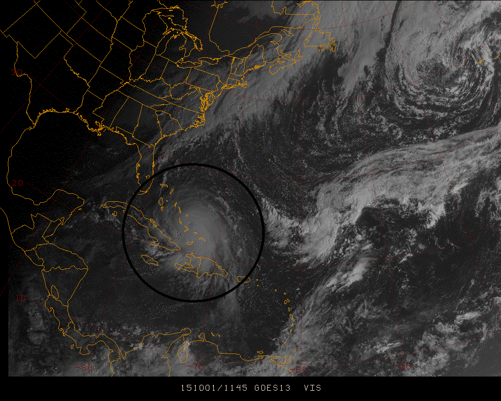 [Latest visible satellite image of Hurricane Joaquin; courtesy Penn State eWall]
6-Day DC Forecast
Today
Cloudy, breezy, quite cool, occasional showers, highs near 60 degrees
Tonight
Cloudy, windy, cool, periods of rain, lows in the lower 50’s
Friday
Cloudy, windy, quite cool, periods of rain, mid 50's
Friday Night
Cloudy, windy, cool, periods of rain, low 50’s
Saturday
Cloudy, windy, cool, showers likely, low-to-mid 60’s
Sunday
Cloudy, windy, cool, more rain possible depending on the track of Joaquin, mid-to-upper 60’s
Monday
Cloudy, windy, cool, more rain possible depending on the track of Joaquin, mid-to-upper 60’s
Tuesday
Partly sunny, cool, still the threat for showers, upper 60’s
Discussion
The combination of a cold front, strong high pressure to the north, and a "nor'easter-like" low pressure system will produce heavy rainfall and strong, long-lasting onshore winds in the Mid-Atlantic region from later today into Saturday. Beyond that, another round of heavy rain and strong winds is possible here depending on the track of Hurricane Joaquin; however, there is the chance that this tropical system stays out to sea.
Hurricane Joaquin strengthened overnight into a category 3 ("major") hurricane now with sustained winds of 120 mph. It continues on a southwest track at slow speeds, but soon will be changing direction as deep upper-level low sets up in the Southeast US. Once Joaquin is captured by the deep upper-level low, it will turn towards the north and begin to close in on the US east coast. Whether it then turns northwest towards the Mid-Atlantic coastline is still uncertain and there certainly is the chance that Joaquin remains out to sea. The intensification of Joaquin could continue in the near future as it remains over warmer-than-normal waters and is in a rather favorable environment with little or no wind shear.
Stay tuned - nothing is set in stone yet regarding Joaquin.
Video
httpv://youtu.be/dZjkhUpwxWo