2:00 PM | **Snow shower threat doesn't end until later tonight...snow squalls possible between 5 and 9pm...weekend threat continues**
Paul Dorian

6PM forecast map by the HRRR model of radar reflectivities (blue=snow, green=rain); courtesy Weather Bell Analytics
Arctic frontal passage
An energetic Arctic front with copious upper-level support is wreaking havoc today from the Ohio Valley to central and western sections of PA and NY. Buffalo, NY just recorded thunder snow with a wind gust to 64 mph and State College, PA broke its longest snowless streak ever recorded with a coating of the white stuff earlier today. While there will be flurries and snow showers this afternoon in the I-95 corridor, the heaviest band may not arrive until early tonight. Also, much like a summertime situation, don't be surprised to see some sunshine break out later this afternoon just ahead of the main squall line band of precipitation. A high-resolution computer forecast model (HRRR) is indicating that an impressive band of precipitation will arrive in the DC-to-Philly-to-NYC corridor approximately between 5 and 9PM (5-6pm DC, 7pm Philly, 8-9pm NYC). This band can be mixed with or even start as rain, but should end up producing snow and perhaps even a burst of heavier, wind-blown snow with small accumulations. Winds will also get quite gusty this afternoon and early tonight with 50 mph gusts possible in much of the Mid-Atlantic region. Following the frontal passage, reinforcing Arctic air will grip the area on Wednesday holding temperatures generally to the 20’s for highs.
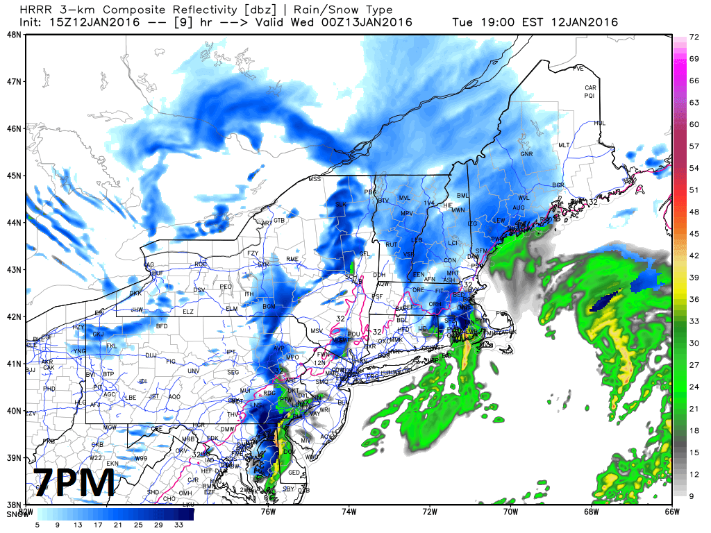
7PM forecast map by the HRRR model of radar reflectivities (blue=snow, green=rain); courtesy Weather Bell Analytics
Weekend threat continues
The weekend threat continues to look quite interesting and complex. A strong wave of energy will approach the west coast tomorrow (and then trek across the country reaching the southern states on Friday. Eventually, a coastal storm is likely to take shape this weekend and while odds initially favor rain in the I-95 corridor, cold air could wrap in causing a changeover to snow at some point – at least in interior locations. There are still too many details to be ironed out for this particular system to have a clear handle on the weekend situation. Stay tuned on this as we will likely not have a good handle on it until later this week when the wave moves over land from the Pacific Ocean. It is quite certain that more very cold Arctic air will follow the weekend system.

8PM forecast map by the HRRR model of radar reflectivities (blue=snow, green=rain); courtesy Weather Bell Analytics
Meteorologist Paul Dorian
Vencore, Inc.