12:05 PM | *Soaking rainfall and thunderstorms with possible damaging wind gusts*
Paul Dorian

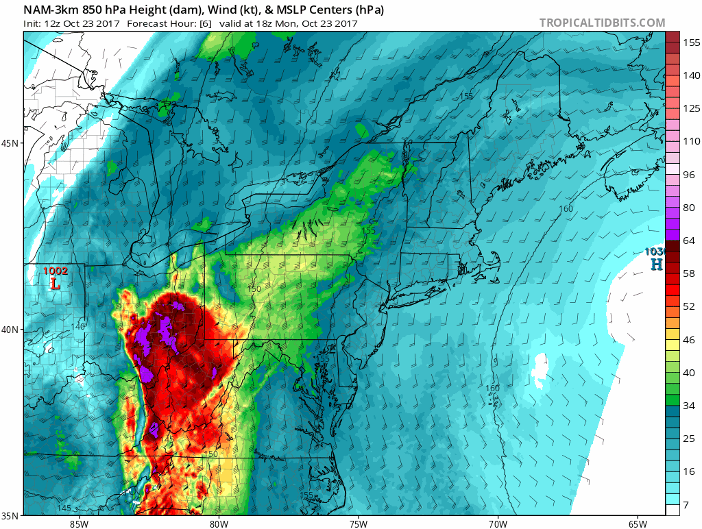
12Z high-resolution (3-km) NAM forecast of lower atmosphere wind speeds from this afternoon into tomorrow evening in 1-hour increments with high levels crossing the I-95 corridor. Courtesy tropicaltidbits.com, NOAA/EMC
Overview
The quiet, dry and warm weather pattern of recent weeks in the Mid-Atlantic region is coming to an end and a soaking rain event is on the way with the possibility for some strong-to-severe thunderstorms as well. The biggest threat from the potential thunderstorms in the I-95 corridor appears to be damaging wind gusts as there will be a rapidly strengthening jet streak at lower levels of the atmosphere tonight and Tuesday and this could translate down to the surface. Following the rain event, cooler air will slide into the Mid-Atlantic region for a few days, but the core of this chilly air mass is headed towards the Southeast US where the difference from normal will be much more noticeable. Looking ahead, another strong cold front will approach the region from our northwest later this weekend and this could lead to another significant rain event on Sunday and which may then be followed by another chilly shot of air early next week.

12Z high-resolution (3-km) NAM forecast of precipitation rates from this afternoon into tomorrow evening in 1-hour increments with a line of showers/storms sweeping into the I-95 corridor. Courtesy tropicaltidbits.com, NOAA/EMC
Today-Friday
Showers and embedded thunderstorms so far today have been primarily focused over the Tennessee Valley, but they will begin to advance from southwest-to-northeast later this afternoon and likely reach the DC metro region this evening and then Philly in the overnight hours. Later tonight, a band of convection associated with a frontal boundary zone will swing northeast to the I-95 corridor and gusty showers with embedded thunderstorms should break out near and after midnight in the DC metro region and in the wee hours of the morning near Philly. Indications are there will be strong lower-level winds forming in the overnight hours and this could result in some damaging wind gusts in the I-95 corridor later tonight and Tuesday.

The latest satellite image features a very healthy looking system that is producing significant rainfall and embedded strong-to-severe thunderstorms for much of the eastern US; courtesy GOES
On Tuesday, the heavy rain and thunderstorm threat will shift away from the DC metro region and be focused across eastern PA, New Jersey, and New York City. In fact, the sun could break out later tomorrow in the DC metro region while heavy rain continues to fall in and around NYC where a few inches could actually accumulate by later tomorrow night. Cooler air pushes into the I-95 corridor on Wednesday and it'll stick around for a few days.
Weekend/early next week
The weekend will feature another strong cold front dropping to the southeast from the Northern Plains/Upper Midwest and this could ultimately result in more soaking rain for the Mid-Atlantic region as we close out the weekend. There could even be a coastal storm that forms along the incoming frontal boundary zone by the end of the weekend. Following that next frontal passage, chilly air for this time of year is likely to pour into the Mid-Atlantic region during the early part of next week.
Stay tuned…it's going to be quite an interesting weather pattern during the next couple of weeks.
Meteorologist Paul Dorian
Vencore, Inc.
vencoreweather.com
Today's video discussion: