
3:05 PM | *Snowflakes not far away late tomorrow…intense cold blast for Friday/Saturday*
Paul Dorian

12Z GEFS 850 mb temperature anomalies for Friday morning; map courtesy tropicaltidbits.com, NOAA/EMC
Overview
The week started off on a warm note here in the Mid-Atlantic region, but it’ll turn noticeably colder tomorrow following the passage of a cold frontal system which will stall out over the southern Mid-Atlantic. In fact, low pressure will form along the frontal boundary zone on Tuesday and it’ll spread a chilly rain to many areas and there can even be some snowflakes mixed in tomorrow night in the higher elevations of northwest NJ and northeast/east-central PA. An even stronger (Arctic) cold front will arrive on Thursday night and this will be followed by an intense blast of cold air for Friday and Saturday which should result in the 20’s by early Saturday morning.
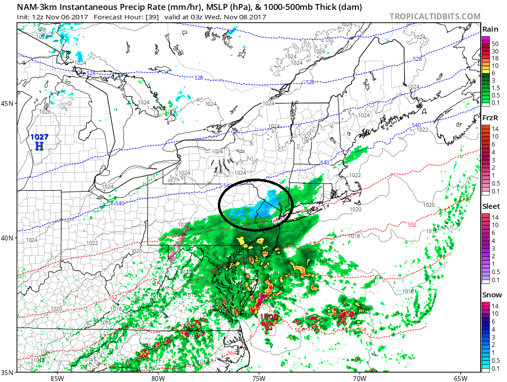
12Z NAM (3-km) forecast map for late tomorrow night with snow (blue) depicted in the higher elevations of NW NJ, Northeast and east-central PA; map courtesy tropicaltidbits.com, NOAA/EMC
Tuesday chilly rain/possible snowflakes nearby
Low pressure will form along a stalled out frontal boundary zone on Tuesday over the Tennessee Valley and head towards the Mid-Atlantic coastline. As colder air filters in from the northwest, it is not out of the question that some snowflakes mix in to the northwest of the I-95 corridor in higher elevation locations as northwest NJ and northeast/east-central PA. The latest high-resolution model run of the NAM actually depicts snow (in blue) for tomorrow night in some of these high elevation locations as the low pressure system slides off the Mid-Atlantic coastline.
Late week cold blast
Another strong cold front will arrive in the I-95 corridor on Thursday night and this will usher in an intense cold blast that will feature the coldest air mass of the season so far. Temperatures by early Saturday morning are likely to be in the 20’s in many spots of the I-95 corridor and highs on Friday and Saturday will be well below normal. In fact, this air mass will be some of the coldest air relative-to-normal in all of North America as the week comes to a close. This air mass will modify rather quickly and Sunday promises to be less harsh in the immediate I-95 corridor.
Meteorologist Paul Dorian
Vencore, Inc.
vencoreweather.com