
2:15 PM | *Active weather pattern continues into the new year with two systems to monitor for next week*
Paul Dorian
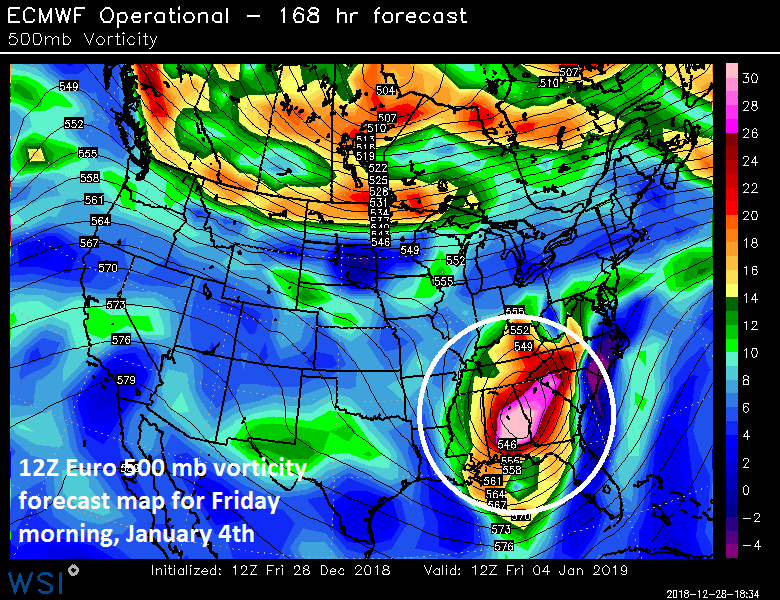
12Z Euro forecast map of 500 mb vorticity as of Friday morning, January 4th; courtesy WSI, Inc., ECMWF
Overview
As the eastern US suffers through yet another soaking rain event to close out this shortened work week, seeds are already being sown for another rain event early next week as this active weather pattern looks like it will continue right into the new year. Today’s system plunged into the Southwest US earlier this week and is now headed towards the Great Lakes region and well to the west of the I-95 corridor. Given this well inland track, warmer air has surged northward along the eastern seaboard resulting in plain rain around here and it looks like there may be a repeat performance by the atmosphere early next week.
On Monday, strong energy in the upper atmosphere will pull out of the Southwest US and head towards the eastern Great Lakes - once again keeping the east coast in the warm sector with plain rain likely from later Monday into early Tuesday. Colder air will then filter into the Mid-Atlantic region at mid-week at the same time another strong wave of energy drops into the Southwest US. It is still unclear and many days away, but there is a chance that this system may end up taking more of a southern track late next week which would make it a bit trickier in terms of rain versus snow in the Mid-Atlantic region; however, cold air will likely only be marginal.
Saturday/Sunday
The weekend will turn out to be primarily dry in the DC-to-Philly-to-NYC corridor and it’ll turn gradually colder following the passage of a cold frontal system later tonight. Winds will pick up late tonight out of the NW and temperatures should peak near 50 degrees for highs on Saturday and then much closer to the 40 degree mark on Sunday afternoon.

12Z Euro forecast map of 500 mb vorticity as of Monday evening, December 31st; courtesy WSI, Inc., ECMWF
Monday/Monday night
Yet another low pressure system will pull out of the southwestern states on Monday and it appears this too will slide to the west of the I-95 corridor. As a result, milder air is likely to push back into the Mid-Atlantic region on Monday and plain rain is likely to break out in the PM hours. Temperatures will start off the day at chilly levels, but given the expected track of the storm to our west, milder air should surge northward along the east coast and likely boost afternoon temperatures to the 50’s. The rain is likely to continue into the Monday night, New Year’s Eve, and then wind down by early Tuesday as drier air arrives following the departure of the early week storm.
Mid-to-late week
An Arctic outbreak is likely to plunge into the Northern Plains early next week and temperatures may drop to well below zero levels by mid-week in that part of the country. After the initial plunge into the Northern Plains, the upper atmospheric setup will act to slow down the cold air push to the southeast and it will only grudgingly cross over the Ohio Valley and inch its way towards the Mid-Atlantic. At the same time, there will be lots of moisture meandering across the south-central states as another vigorous wave of energy kicks out of the Southwest US. It is simply too early to tell for certain, but this next system could take more of a southern track later next week and not slide to the west of the I-95 corridor like the previous couple of storms. A southern track would make for a tougher call in the Mid-Atlantic region with respect to rain versus snow should the storm ultimately come this far north; however, the cold air in place looks like it will be only marginal. Any potential impact in the Mid-Atlantic region from this system would likely be in the later Thursday/Friday time frame.
Stay tuned.
Meteorologist Paul Dorian
Perspecta, Inc.
perspectaweather.com
Video discussion: