
12:30 PM Friday | ***Weekend accumulating snow for the Mid-Atlantic region***
Paul Dorian
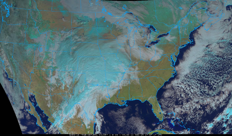
GOES-16 “natural color” satellite image at mid-day Friday featuring copious amounts of clouds in the heartland associated with developing system; courtesy NOAA/GOES, College of DuPage
Overview
Accumulating snow is falling today in the Colorado Rockies and this storm system will spread snow this weekend from the central Plains to the Mid-Atlantic. Low pressure will be located over Oklahoma early tomorrow and generally head in an eastward direction towards the Tennessee Valley, and ultimately, will transfer its energy to the coastal region of North Carolina. Snow will break out early Saturday in the central Mississippi Valley and then advance eastward to the Ohio Valley by mid-day and to the Mid-Atlantic region during the late PM hours. On Sunday, as low pressure takes over at the North Carolina coastline, snow will wind down from northwest-to-southeast and it’ll last the longest in areas south of the PA/MD border. Heaviest amounts of snow during this upcoming weekend event in the Mid-Atlantic region are likely to take place in parts of Virginia, Maryland, Delmarva Peninsula and interior southern New Jersey.

Snow reaches the Mid-Atlantic region by early tomorrow night (snow shown in blue); map courtesy NOAA/EMC, tropicaltidbits.com
Weekend snow event
Early Saturday, low pressure will be located over Oklahoma and then head east towards the Tennessee Valley. At the same time, strong cold Arctic high pressure will slide eastward across southern Canada providing the Mid-Atlantic region with plenty of cold air for the entire weekend event. Significant snow will break out by early tomorrow across the central Mississippi Valley with several inches on the way from Missouri-to-Indiana. Snow will advance eastward across the Ohio Valley at mid-day and arrive in the Mid-Atlantic region later in the afternoon or early tomorrow night. The snow may actually have trouble reaching the ground at the onset around here as the low-level air will be so dry (and cold) with dew points likely in the single digits across, for example, southeastern Pennsylvania. The radar may actually make it appear that it should be snowing outside at the onset while nothing is actually reaching the ground (known as virga). The snow will begin to reach the ground once the lower levels of the atmosphere become somewhat better saturated.

Snow in the Mid-Atlantic region early Sunday with the initial surface low pressure system over Tennessee and a secondary beginning to appear near the North Carolina coastline; map courtesy NOAA/EMC, tropicaltidbits.com
By late tomorrow afternoon, it should be snowing quite nicely in the DC metro region and then in the Philly metro region by early tomorrow night. The New York City metro region will be on the northern fringes of the weekend snow event thanks, in part, to that very cold and dry air mass which is going to be anchored by strong high pressure located in southeastern Canada. On Sunday, low pressure will intensify near the North Carolina Outer Banks region and snow will wind down from northwest-to-southeast in the Mid-Atlantic with the longest-lasting snow likely south of the PA/MD border in the region extending from Virginia to the Delmarva Peninsula to southern New Jersey.

Well-defined upper-level energy on Saturday morning over the central Plains (12Z FV3-GFS forecast map); map courtesy NOAA/EMC, tropicaltidbits.com
In addition to the strong high to the north, another key aspect of this weekend event will be the upper-level energy. The upper-level support for this system will be rather impressive early tomorrow over the central Mississippi Valley with a rather well-defined feature at 500 mb. Indeed, this pattern should support the expected heavy snowfall for the region from Missouri-to-Illinois-to-Indiana. As the upper-level energy pushes to the east; however, it’ll become sheared or “strung-out” and this will inhibit somewhat any chances for major snow accumulations in the Mid-Atlantic region.

Upper-level energy is sheared or “strung-out” by Sunday morning (12Z FV3-GFS forecast map); map courtesy NOAA/EMC, tropicaltidbits.com
In terms of snow accumulations (and timing), the estimates for the Mid-Atlantic region are as follows:
NYC metro region: a coating to an inch or two (Saturday night)
Philly metro region: 1-3 inches with the higher amounts to the west and south of Philly and the lower amounts to the north and east (primarily a Saturday night event, but snow could begin as early as late Saturday afternoon and end as late as early Sunday)
DC metro region: 3-6 inches with the higher amounts to the west and south of the District and the lower amounts to the north and east (mid-to-late Saturday afternoon into the late afternoon on Sunday)…biggest snowfall of the winter season so far in the DC region!.

Total snowfall accumulations in the US as predicted by the 12Z FV3-GFS computer forecast model between today and Monday afternoon (totals include sleet); courtesy NOAA/EMC, tropicaltidbits.com

12Z Euro on board with weekend snow accumulations in the Mid-Atlantic region; map courtesy weather.us, ECMWF
Looking ahead
One final note, the snowstorm in December that hit southern parts of the Mid-Atlantic region and the one in November that hit the DC-to-NYC corridor quite hard turned out be to relatively isolated snow events for the first part of the winter season. This upcoming weekend snow event, however, will likely be just the opening act in what promises to be a relatively long-term colder and snowier-than-normal weather pattern that’ll get underway in earnest later this month….more on that next week including the possibility of a storm around 20 Jan.
Meteorologist Paul Dorian
Perspecta, Inc.
perspectaweather.com
Video discussion: