
11:40 AM | **Impressive Arctic cold for early March across much of the nation**
Paul Dorian

2-meter temperature anomalies for early this afternoon with colder-than-normal conditions virtually from coast-to-coast; courtesy NOAA/EMC, tropicaltidbits.com
Overview
A widespread outbreak of Arctic air has encompassed much of the nation and it will actually get worse in the Mid-Atlantic/Northeast US before it gets any better. Record or near record low temperatures extended across much of the nation both this morning and yesterday morning and there will no doubt be more record-breaking cold over the next couple of mornings. The next threat for snow in the Mid-Atlantic region comes on Friday, but it currently does not look like a significant event.

Great Lakes ice cover has increased to nearly 75% in recent days and should go even higher in this bitter cold; courtesy NOAA
Impressive cold
Here are some of the notable temperatures across the nation during the past couple of mornings:
Monday, March 04
* -6 deg in Denver coldest in March since 1960
* -13 deg in Minneapolis, MD, ties daily record from 1873
* -25 deg in North Platte, Neb, coldest ever in March
* -34 deg in Lewiston, Mont, coldest ever in March
* -46 deg in Elk Park, Mont, lowest temperature ever so late in the season in the state of Montana
Tuesday, March 05
* -33 deg in Bozeman, MT, coldest ever in March
* 0 deg in Pasco, WA, coldest ever in March
* +8 deg in The Dalles, OR, coldest ever in March
* +21 deg in Kelso-Longview, WA, coldest ever in March
* +21 deg in Portland, OR, coldest ever in March
* +19 deg in Shelton, WA, coldest ever in March
* +1 deg in Pendelton, OR, coldest ever in March
* +7 deg in La Grande, OR, coldest ever in March
In many cities, the record cold has brought the lowest temperatures ever recorded for the month of March. In the east, the cold has not reached rock bottom yet. A frontal boundary zone will cross the Great Lakes later today and push through the Mid-Atlantic/Northeast US in the overnight hours and this will usher in the coldest air for the day on Wednesday. In addition to the cold, the winds will pick up noticeably later tonight and Wednesday resulting in painfully cold wind chill values. Temperatures on Wednesday will likely be confined to the 20’s for highs in the DC-to-Philly-to-NYC corridor – some 20 degrees below-normal for this time of year. Meanwhile, the ice cover on the Great Lakes has increased to nearly 75% - well above normal - and this will likely continue to climb over the next few days given the extensive cold in that part of the nation. Ice cover content on Lake Superior has climbed to 90% and may top that mark over the next few days.

Record or near record low temperatures on Monday morning (left) and this morning (right); courtesy coolwx.com
Next snow threat
A wave of energy will cross the country over the next couple of days and it will arrive in the Mid-Atlantic region early Friday. As a result, some snow is possible on Friday for at least parts of the Mid-Atlantic, but at this point, it doesn’t look significant with small accumulations only on the table.
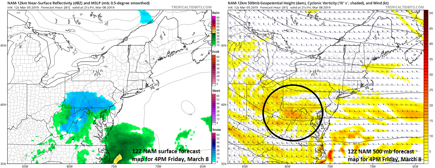
The next snow threat for the Mid-Atlantic region comes on Friday when a wave of upper-level energy (right) slides across the nation and reach this area; courtesy NOAA/EMC, tropicaltidbits.com
A more important system will likely bring a soaking rain event into the eastern states on Sunday, but it could be cold enough at the start in some higher elevation regions of the Mid-Atlantic/Northeast US for something frozen at the onset (e.g., NE PA).
Meteorologist Paul Dorian
Perspecta, Inc.
perspectaweather.com
Video discussion: