11:50 AM (Tuesday) | *Unusual movement of an unfolding western Atlantic storm will keep it unsettled in the Northeast US*
Paul Dorian

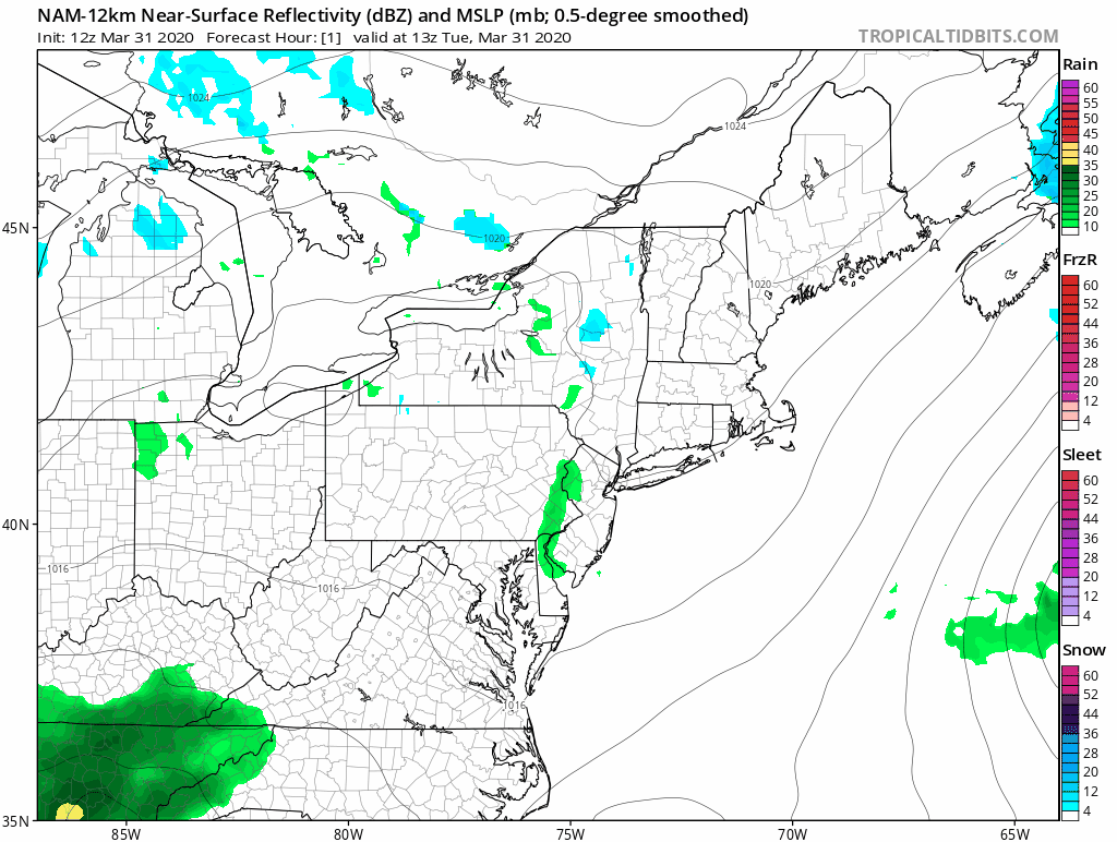
Low pressure pushes off the Carolina coastline later tonight and then retrogrades back towards the Northeast US in coming days as it encounters a blocking pattern in the atmosphere; maps courtesy NOAA, tropicaltidbits.com
Overview
Low pressure will push off the Carolina coastline later tonight and make a move to the northeast out over the open waters of the western Atlantic. It will not, however, continue in this direction for too long before it encounters a blocking pattern in the upper part of the atmosphere which will lead to an unusual movement in coming days as it will retrograde back towards the Northeast US. This low pressure system is producing rainfall today across the southern Mid-Atlantic and then, as it retrogrades back around late this week, it could swing a band of clouds and showers from northeast-to-southwest through the Northeast US and into the Mid-Atlantic region.

A teleconnection index known as the North Atlantic Oscillation (NAO) is now in negative territory (values shown in blue) and will remain there in coming days. This type of condition is favorable for “high-latitude blocking” when it takes place this time of year. Map courtesy NOAA
Details
One of the teleconnection indices that provides some information about the temperature and pressure pattern across the North Atlantic can also provide us with some clues as to whether there is a chance for “high-latitude blocking” in the upper part of the atmosphere. This particularly index known as the North Atlantic Oscillation (NAO) is now in negative territory and it should remain there for several days which is a favorable sign for blocking that normally features strong high pressure ridging near Greenland. This unfolding low pressure system will head off the east coast later tonight will make a move to the northeast, but it’ll encounter a blocking pattern in the atmosphere with nearly stationary high pressure sitting over Greenland. In turn, this blocking will force the low pressure system to retrograde or loop back around towards the Northeast US in coming days instead of going out over the open waters of the Atlantic Ocean.

Low pressure and its associated upper-level energy will push off the Carolina coastline later tonight and then retrograde back towards the Northeast US in coming days as it encounters a blocking pattern in the atmosphere; maps courtesy NOAA, tropicaltidbits.com
The offshore storm will likely result in “storm” conditions out over the western Atlantic during the next few days and unsettled conditions around here with plenty of clouds on Wednesday and spotty showers thanks to cold air aloft, low level moisture from a prolonged easterly flow. On Thursday, as this offshore system strengthens and begins to loop back around towards the coast, the NW winds will pick up noticeably in intensity gusting past 30 mph or so. By Thursday night or early Friday, a band of showers may swing through the Northeast US and into the Mid-Atlantic region from northeast-to-southwest as the offshore low makes its closest approach. Over the weekend, high pressure from our west is likely to bring about more settled conditions in this region along with milder temperatures.
Meteorologist Paul Dorian
Perspecta, Inc.
perspectaweather.com
Follow us on Facebook, Twitter, YouTube
Video discussion: