1:00 PM | ***Winter storm in the Mid-Atlantic from later Monday into Tuesday…primarily snow, ice north of PA/MD border…ice, rain, and maybe some snow south of there…second threat later next week***
Paul Dorian

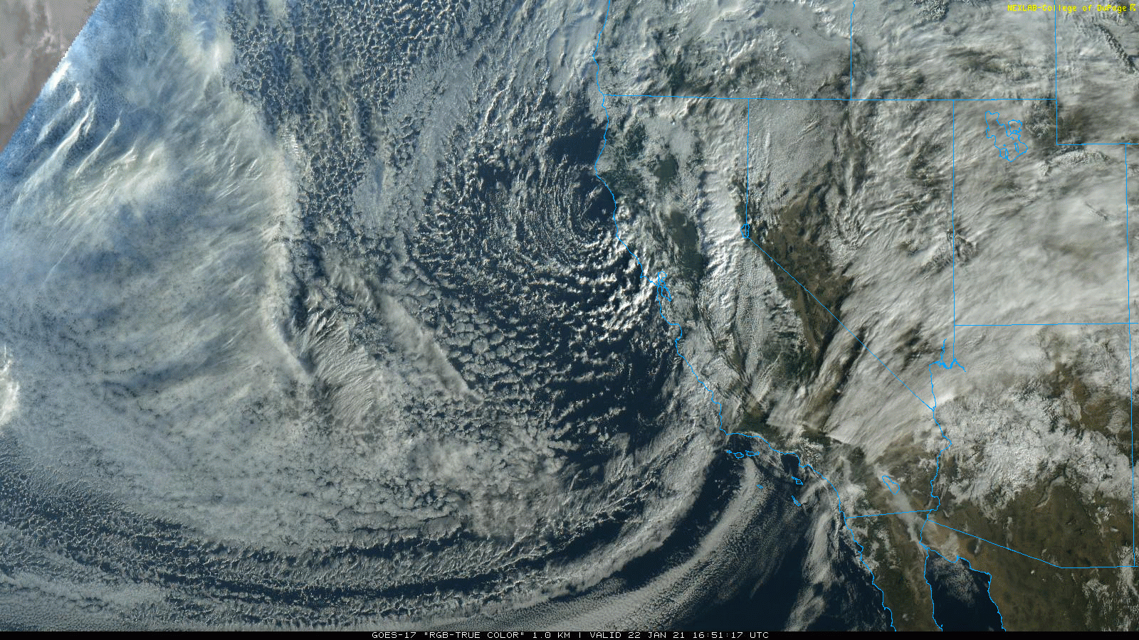
The satellite imagery loop at mid-day features a “swirl” in the clouds near the northern California coastline and this disturbance will generate a winter storm that will impact the Midwest and Mid-Atlantic region early next week. The video discussion (see below) features a satellite imagery loop of the Alaska region which features a disturbance will play a key role in another storm threat for the eastern US later next week. Images courtesy NOAA/GOES, College of DuPage
Overview
A frontal passage later today will usher in a very cold, dry air mass for the weekend in the Mid-Atlantic region with highs confined to the 30’s on both days all along the I-95 corridor. This cold, dry air mass will still be in place on Monday morning when moisture begins to head in this direction from a low pressure system over the Ohio Valley. A second low pressure area will form off the Mid-Atlantic coastline by early Tuesday and the combination of these two systems will result in a wintry mess in the Mid-Atlantic region from later Monday into Tuesday.
In areas to the north of the PA/MD border, snow and/or ice are likely to be the primary precipitation types and accumulations of up to a few inches are on the table. To the south of the PA/MD border, there is likely to be a mix of ice and rain with some snow possible at times and small accumulations are possible. Another storm could impact the Mid-Atlantic region later next week; however, its northward reach is still uncertain this far in advance and it could be suppressed to the south. Looking way ahead, there can be yet another storm threat a few days later as the active weather pattern continues into the early part of February.

Two upper-level disturbances are on the North America weather map this afternoon and they will play big roles in the two winter storm threats next week for the Midwest and Mid-Atlantic. One system has just reached the northern California coastline and it will play a factor in the early week winter storm threat for the Midwest and Mid-Atlantic. A second system now over the Aleutian Islands of Alaska will help to produce another storm system that could threaten the eastern US late next week. Map courtesy NOAA, tropicaltidbits.com
Details
California will be hit hard by several storms during the next couple of weeks with heavy coastal rainfall and likely some absolutely incredible snowfall amounts in the Sierra Nevada Mountains. The first upper-level disturbance is now pushing into northern California and it is this system that will spawn the winter storm that will impact the Midwest and Mid-Atlantic region early next week. In the near-term, a strong cold front will pass through the Mid-Atlantic region later today and it could spark a few showers of snow, graupel (i.e., snow pellets) and/or rain. A very cold air mass will then ride into the area on increasingly strong NW winds from later tonight into Saturday and isolated snow showers are possible at any time. Temperatures later tomorrow night will drop into the teens in many suburban locations along the I-95 corridor and it stays quite cold on Sunday. There is the chance for some snow shower activity later in the day on Sunday or during Sunday night as a weak forerunner disturbance pushes out ahead of the main system.

A winter storm will impact the Midwest and Mid-Atlantic region early next week with snow, ice and/or rain. The timetable for the precipitation in the DC-to-Philly-to-NYC corridor is from later Monday into late Tuesday. Map courtesy NOAA, tropicaltidbits.com
On Monday, low pressure will pull out of the south-central states and head towards the Ohio Valley. A secondary low pressure system will begin to form late Monday night/early Tuesday just off the Mid-Atlantic coastline. The day will start off on the cold, dry side in the DC-to-Philly-to-NYC corridor as moisture begins to head in this direction from the west-to-southwest.
In the DC metro region, precipitation in the form of ice and/or rain is likely to arrive during the afternoon hours and then continue into Tuesday. The morning commute on Monday looks like it will be precipitation-free in the DC metro region. There is a chance that any ice or rain that falls can change to snow during the latter stages of the storm on Tuesday as the Mid-Atlantic coastal storm takes over and pulls colder air southeastward. Small accumulations are possible during this storm; especially, in the far northern and western suburbs of DC.
In areas to the north of the PA/MD border, the early week winter storm is likely to be primarily a snow and/or ice event with precipitation arriving by the end of the afternoon or early evening hours on Monday and continuing into late Tuesday. The snow/ice may actually linger for quite awhile during the day on Tuesday across Pennsylvania, interior New Jersey and southern New York as the coastal low intensifies. The morning commute on Monday looks like it will be precipitation-free in the Philly and NYC metro regions. Accumulations of up to a few inches of snow are on the table from the Philly suburbs to the New York City metro region - several inches of snow are likely across upstate Pennsylvania.

A second storm may threaten the Mid-Atlantic region late next week. That system is likely to have plenty of cold air in place ahead of it which could result in primarily snow; however, its northern extent is still uncertain this many days in advance. Map courtesy NOAA, tropicaltidbits.com
The on-going active weather pattern is likely to feature another very strong upper-level disturbance pushing into the western US from the Pacific Ocean by the early part of next week. This second system which is currently far out over the northern Pacific Ocean (Aleutian Islands of Alaska) will take a rather similar track initially as the early week winter storm system by moving across the central Plains. However, it is unclear right now if it will be suppressed thereafter to the south of the Mid-Atlantic region as it pulls out of the central US and heads towards the east coast. There will be plenty of cold air in place in the Mid-Atlantic region for this potential storm later next week. Therefore, if it were to come this far north, it could result in primarily snow for the Mid-Atlantic region and potentially significant amounts. This far in advance and with still a few days to go before the system even arrives over the western US, it is just too uncertain to predict the northern extent of this potential late week storm. Yet another system could reach California by the middle of next week and then push west-to-east across the nation and possibly impact the Mid-Atlantic region by the beginning of February….buckle up.
Meteorologist Paul Dorian
Perspecta, Inc.
perspectaweather.com
Follow us on Facebook, Twitter, YouTube
Video discussion: