10:00 AM (Thurs) | ***Intense snow bands north of the PA/MD border from SE PA to NJ…icy buildup southern Mid-Atlantic including DC metro region…some impacts possible into late Friday***
Paul Dorian

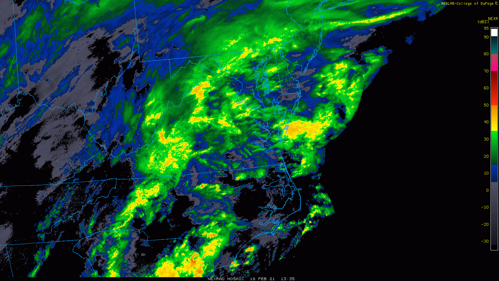
Precipitation will continue at varying rates next several hours including some heavier bursts. Maps courtesy College of DuPage, NOAA
Overview
The latest winter storm continues to pound away at the Mid-Atlantic with lots of snow north of the Pennsylvania/Maryland border and lots of icing to the south of there. There have been intense snow bands in the region from southeastern Pennsylvania to central New Jersey during the past few hours resulting in a quick piling up of snow to as much as 8 inches in some spots. The precipitation will tend to slacken off this afternoon, but this latest winter storm will turn into another relatively long duration event with redevelopment of the precipitation by tonight and there can be some impacts into the latter part of the day on Friday.

Mid-level “frontogenetic forcing” will cause more bands of intense precipitation during the late morning and mid-day hours across portions of the Mid-Atlantic. Map courtesy NOAA
North of PA/MD border including Philly, NYC metro regions
Snow has piled up quickly this morning from the latest winter storm in an area stretching from southeastern PA to central NJ. In fact, some suburban areas outside of Philly have already reported as much as 8 inches of snow and it continues to fall rather heavily in many spots. Sleet has crept northward in the past few hours and there will be a battle between snow and sleet during the afternoon hours with a mix likely much of the time in the Philly-to-NYC corridor. There can be a continuation of heavy bursts of precipitation during the next couple of hours through mid-day/early afternoon, but the precipitation can actually slacken off later this afternoon before picking up again tonight. A wintry mix early tonight can change back to all snow by later tonight in much of the I-95 corridor region. The winter storm will have an impact on Friday as well with snow or a wintry mix continuing at times before winding down and there can be additional accumulations – and we’ll have to watch for potential last minute surprises on Friday.
Philly metro region (totals by early Friday): 4-8 inches with isolated higher amounts of up to a foot, an icy buildup likely on top of the snow
NYC metro region (totals by early Friday): 4-8 inches with isolated higher amounts of up to a foot, an icy buildup likely on top of the snow

Precipitation can slacken off later this afternoon, but it should re-develop tonight and continue at times well into the day on Friday. Map courtesy NOAA, tropicaltidbits.com
South of PA/MD border including DC metro region
Snow quickly mixed with sleet in the DC metro region earlier today and the rest of the day will see a battle between sleet and freezing rain although snow can mix back in at times; especially, in the far western and northern suburbs. Watch for the continuation of heavier bursts over the next couple of hours, but the precipitation can slacken off at times during the mid-day and afternoon hours. An icy buildup is going to cause continuing difficult travel conditions right through the day; especially, on any untreated surfaces. The wintry mix will re-develop later today and early tonight and it could change back to all snow by early Friday. The storm will have a lingering effect on Friday with occasional snow, sleet and/or rain possible before it winds down and there can be additional accumulations – and we’ll have to watch for potential last minute surprises on Friday.
DC metro region (totals by early Friday): a coating to a couple of inches of snow in the District and nearby suburbs; 2-4 inches far northern and western suburbs; an icy buildup of a tenth to quarter inch possible

Another round of snow is possible later tomorrow in the I-95 corridor in this latest long duration event. Map courtesy NOAA, tropicaltidbits.com
Stay tuned for further updates.
Meteorologist Paul Dorian
Perspecta, Inc.
perspectaweather.com