12:45 PM | "Long-lost" satellite images shed new light on global sea ice...enormous holes found in the Arctic ice back in the 1960's...Antarctica sea ice reached record highs and lows just two years apart
Paul Dorian
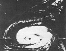 [Hurricane Gladys as seen by NASA’s Nimbus 1 satellite in September 1964; courtesy NASA]
Discussion
Overview NASA launched the first of seven Nimbus spacecraft to study Earth from space in August 1964 and fifty years later experts at the National Snow and Ice Data Center in Boulder, Colorado are recovering long-lost images from old Nimbus data tapes and black-and-white film. The preliminary findings from long-lost images from the 1960’s have produced some big surprises with respect to global sea ice. In much the same way archeologists dig up artifacts that can rewrite history, these long-lost satellite images have to potential to rewrite our knowledge of ever-changing global sea ice cycles.
The Nimbus program Fifty years ago NASA launched the first in a series of Earth-observing satellites that revolutionized how scientists study Earth’s weather systems, environment and atmosphere. The Nimbus satellites were a series of seven Earth-observation satellites launched over a 14-year time period from 1964 to 1978, one of which did not achieve orbit. In total, the satellites provided Earth observations for 30 years and collectively carried a total of 33 instruments, including ozone mappers, the Coastal Zone Color Scanner instrument and microwave and infrared radiometers. The Nimbus series were the first meteorological satellites to provide day and night local area coverage every 24-hours, repeated at the same time daily. This “sun-synchronous” orbit became the norm for satellites in subsequent years. Nimbus were also the first satellites to provide day and nighttime pictures of intense hurricanes as viewed from space which initiated the use of satellite technology to provide hurricane warnings (example image above). Many at NASA's Goddard Space Flight Center (Greenbelt, MD) regard Nimbus as the "granddaddy of the current Earth-observing fleet" and the overall program as a "smashing success and a huge return on investment".
Nimbus satellite observations were transmitted as an analog signal and then burned onto film and stored in canisters labeled only by orbit number (i.e., no indication of geography). The only way to retrieve this imagery data into usable format by specific land area was to scan all of it which meant 250,000 images. Now the satellite imagery data is completely digital and can be managed and manipulated by scientists in order to get a look at the past. Initial work with the newly-digitized satellite data has been performed for the 1964-1969 time period and now the year 1970 is being analyzed.
Global Sea Ice In terms of global sea ice, our current satellite data records are quite good for a little more than the past 30 years or so. Pushing it back another 15 or 20 years could be crucial in the understanding of global sea ice cycles which have been occurring throughout history. Indeed, early findings have been quite surprising with respect to both the Arctic and Antarctica sea ice extent. According to NASA scientists, while there was more ice compared to today, there have been “enormous holes" found in the Arctic ice that "we didn’t expect and can’t explain” in a decade considered to be colder-than-normal (i.e., the 1960's). The Antarctica sea ice extent findings are perhaps even more amazing. Using these long-lost satellite images, it appears that the Antarctica sea ice extent reached record high levels in 1964 only to be followed by record low amounts just two years later in 1966, and the earliest maximum sea ice extent was seen in 1969. As is often the case with more data, it often leads to more questions than answers. Video discussion on this by NASA scientists at http://www.youtube.com/watch?v=bvGIE1y3cXA.