
7:15 AM | *La Nina may form in the equatorial Pacific Ocean later this year and, if so, it could have wide-ranging ramifications*
Paul Dorian

NOAA’s CFS v2 computer forecast model is predicting relatively strong La Nina conditions by later this summer (August/September/October); SST anomalies plot courtesy NOAA
Overview
It appears somewhat likely that the current weak El Nino in the equatorial part of the central Pacific Ocean will transition into La Nina conditions later this summer. La Nina is a naturally occurring oceanic cycle that produces colder-than-normal sea surface temperatures (SSTs) in the tropical Pacific Ocean whereas El Nino is associated with warmer-than-normal water. If indeed La Nina forms later this year, it could have ramifications on the upcoming Atlantic Basin tropical season, prospects for drought in California, and potentially on global temperatures in the lower atmosphere.

The plot shows forecasts made by dynamical and statistical models for sea surface temperatures (SST) anomalies in the “Nino 3.4” region for nine overlapping 3-month periods. Note that the expected skills of the models, based on historical performance, are not equal to one another. The skills also generally decrease as the lead time increases. Thirdly, forecasts made at some times of the year generally have higher skill than forecasts made at other times of the year--namely, they are better when made between June and December than when they are made between February and May. Differences among the forecasts of the models reflect both differences in model design, and actual uncertainty in the forecast of the possible future SST scenario.
Computer model forecasts generally support the formation of La Nina
Several independently-made computer forecast models support the idea of a change in the central part of the tropical Pacific Ocean from the current weak El Nino to La Nina conditions by the summer of 2020. The plume of El Nino Southern Oscillation (ENSO) model forecasts from mid-February indicate a transition to La Nina conditions are likely to take hold by later this summer. Indeed, some models (e.g., NOAA’s CFS v2) are predicting a fairly strong La Nina by the end of the summer season with sea surface temperatures as much as 1.5°C below-normal in the "Nino 3.4" region (i.e., central tropical Pacific Ocean).

DESCRIPTION: Warm (red) and cold (blue) periods back to 1990 based on a threshold of +/- 0.5°C for the Oceanic Niño Index (ONI) [3 month running mean of ERSST.v5 SST anomalies in the “Niño 3.4” region (50°N-50°S, 120°-170°W)], based on centered 30-year base periods updated every 5 years.
Possible impact on the 2020 Atlantic Basin tropical season
One of the surprising side benefits of an El Nino event in the tropical Pacific Ocean is that this type of sea surface temperature pattern (i.e., warmer-than-normal) tends to result in less tropical activity in the Atlantic Basin when compared to normal. This tendency for reduced tropical activity in the Atlantic Basin is a result of higher-than-normal vertical wind shear in the breeding grounds region of the Atlantic Ocean during El Nino events. Higher-than-normal vertical wind shear tends to inhibit the formation or intensification of tropical systems.
On the contrary, La Nina is often associated with a more active Atlantic Basin tropical season as overall vertical wind shear is usually on the low side in the breeding grounds region. The last time there was a relatively strong La Nina event during the tropical season in the Atlantic Basin was in the year 2010. This particular year saw La Nina-induced sea surface temperature anomalies as low as -1.7°C in the central part of the equatorial Pacific and there was anomalously low vertical wind shear in the tropical Atlantic. As it turned out, the 2010 Atlantic tropical season was the first in a group of three very active seasons. It is tied alongside 1887, 1995, 2011, and 2012 for the third-most active Atlantic tropical season on record, with 19 tropical storms, only behind the 1933 and the 2005 seasons.

University of Alabama-Huntsville (UAH) satellite-based temperature data of the global lower atmosphere from 1979 to the present. Several El Nino episodes in the past couple of decades were associated with spikes in global temperatures and La Nina often resulted in a drop in temperatures (note - only have labeled the ENSO events on the above plot going back to the 1998 El Nino). Data courtesy UAH, Dr. Roy Spencer
Potential impact on global temperatures
What goes on in the Pacific Ocean in terms of sea surface temperatures can indeed have an impact around the world with respect to global temperatures in the lower part of the atmosphere. If indeed a La Nina does form later this year in the tropical Pacific Ocean and it is relatively strong and long-lasting, it can result in a drop of global temperatures after it becomes well-established. In recent years, the number of El Nino episodes have surpassed the number of La Nina events and global temperatures have often reacted with noticeable spikes (see UAH data temperature plot). For example, the strong El Nino events that centered on the years of 1997/1998, 2009/2010 and 2015/2016 were associated with sharp upticks in lower atmosphere global temperatures. In times of La Nina such as during 2007/2008 and 2010/2011, there have been noticeable downturns in global temperatures of the lower atmosphere.
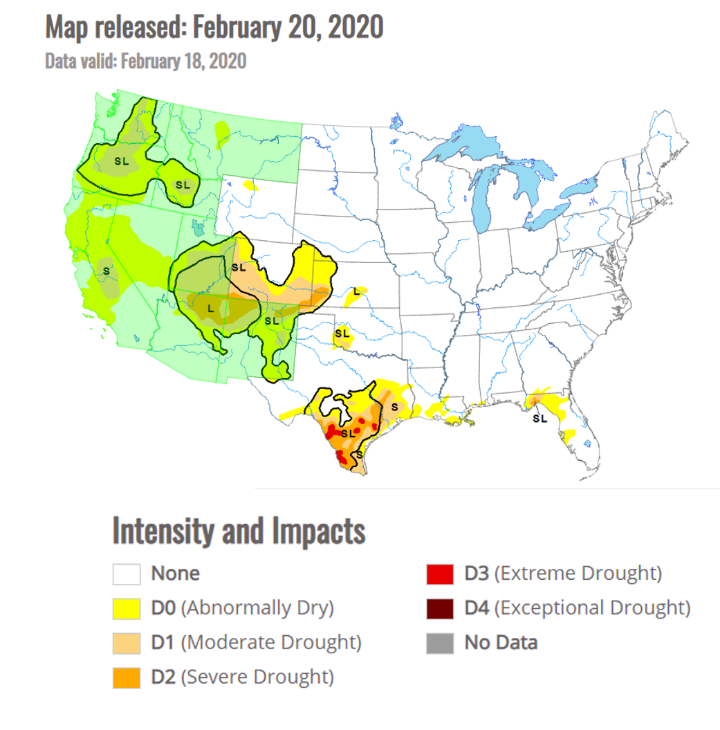
Drought conditions have worsened across California during the past few week; map courtesy NOAA
California drought
After a long period with severe drought conditions dominating the scene in California, the winter season of 2018-2019 brought significant rainfall to the state and incredible amounts of snow piled up in the Sierra Nevada Mountains. In fact, the drought was officially declared over by the time spring season began last year. In subsequent months, there have been spurts of dry weather across California, but drought conditions did not really become persistent until a few weeks ago. Contrary to the winter of 2018-2019, this winter season has been rather dry across California and the amount of snow that has fallen in the Sierra Mountain range of eastern California has been below-normal. This reduction of snowfall in the higher elevation locations could very well lead to some problems later this summer as a melting snow pack is an important contributor of water for the state.
In terms of what kind of an impact La Nina conditions in the tropical Pacific Ocean could have on California’s weather, the results are rather mixed. La Nina tends to create a looping jet stream centered around high pressure in the Pacific Ocean. If the high pressure system anchors around the international dateline, La Nina tends to bring wetter weather to North America. However, if it centers itself in the eastern Pacific Ocean, it tends to bring drier weather. Finally, if the high pressure system meanders around, the results are often periods of wet and dry weather.
Stay tuned…we’ll continue to monitor the prospects for La Nina as we close in on the tropical season in the Atlantic Basin and certainly nothing is set in stone when it comes to long-range model forecasting of sea surface temperatures.
Meteorologist Paul Dorian
Perspecta, Inc.
perspectaweather.com
Follow us on Facebook, Twitter, YouTube