1:30 PM | **Back-to-back Arctic invasions to produce amazing cold around here by early Sunday**
Paul Dorian
Discussion
Overview The normal high temperature for today at Philly’s International Airport is 43 degrees and we are going to end the day several degrees below that mark, but this cold is nothing compared to the type of cold that is coming. Back-to-back Arctic invasions will send temperatures plummeting in the Mid-Atlantic region over the next few days and the second blast is likely to feature the coldest air of the season so far in much of the area from Maine to Florida. The last time temperatures dropped to less than 10 degrees in Philly during the month of February was in 1996 (6 degrees on 2/6/96). There is little doubt that Philly will see temperatures that low on Sunday morning (and again on Monday morning). The last time sub-zero readings occurred in Philly during the month of February was in 1979 (-2 degrees on 2/11/79) and this is not out of the question for the Sunday/Monday Arctic blast.
Thursday night/Friday Arctic blast A clipper system and its associated Arctic frontal system will arrive in the Mid-Atlantic region later tomorrow with scattered snow showers - perhaps even a heavier burst of snow - along with strengthening winds and then it’ll turn brutally cold behind it late tomorrow night and Friday. Temperatures early Friday could bottom out in the upper single digits in some suburban locations along I-95 and they will struggle to reach the 20’s on Friday along with much lower wind chill values.
Sunday/Monday Arctic blast Before that late work week Arctic air mass even has a chance to modify, another clipper system and its associated Arctic front will be plowing towards the Mid-Atlantic region. This system will be accompanied by snow for the I-95 corridor along with strengthening winds from later Saturday into early Sunday and it will usher in absolute frigid air for Sunday and Monday. The snow could turn out to be rather significant in portions of the Northeast US; especially, from New York City north and east. Sunday is liable to turn out to be the coldest day of the winter so far in much of the region between Maine and Florida. Low temperatures early Sunday morning and again early Monday morning could plunge to 0 degrees in many parts of the Mid-Atlantic region. High temperatures on Sunday will be confined to the teens in the I-95 corridor and with winds gusting up to 40 mph or so, there will be dangerously low (sub-zero) wind chill values.
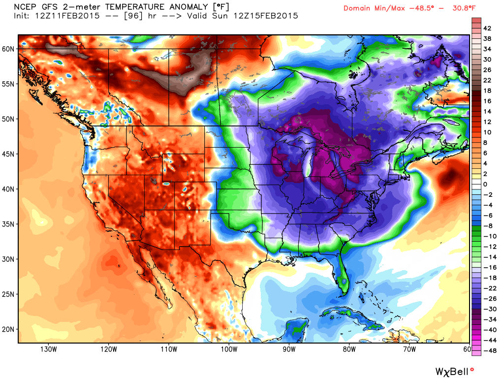
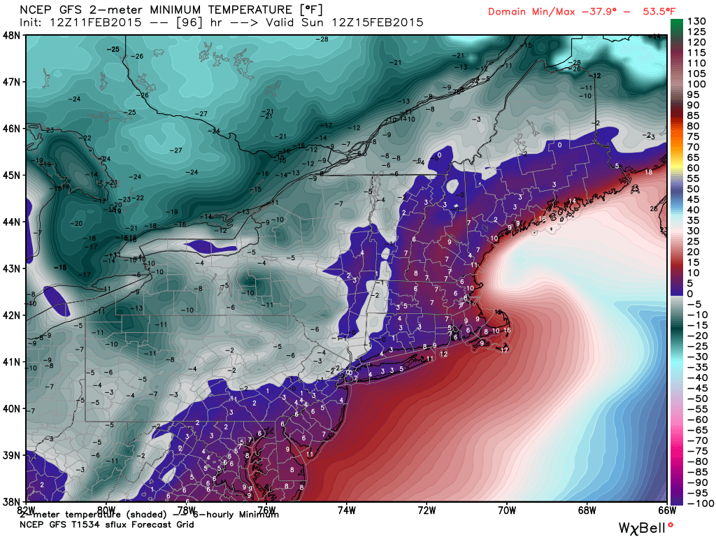
The 12Z GFS 96-hour forecast map for low temperatures on Sunday morning (above) show below zero readings just to the west of the NYC metro region, near zero in the Philly suburbs, and low-to-mid single digits near DC (map courtesy Weather Bell Analytics). The 12Z GFS 96-hour 2-meter temperature anomaly forecast map for Sunday (below) shows the entire eastern half of the nation in a deep freeze and some sections (in purple) are more than thirty degrees below normal for this time of year (map courtesy Weather Bell Analytics).