1:40 PM (Tuesday) | **Severe thunderstorm threat in the I-95 corridor late today/early tonight**
Paul Dorian

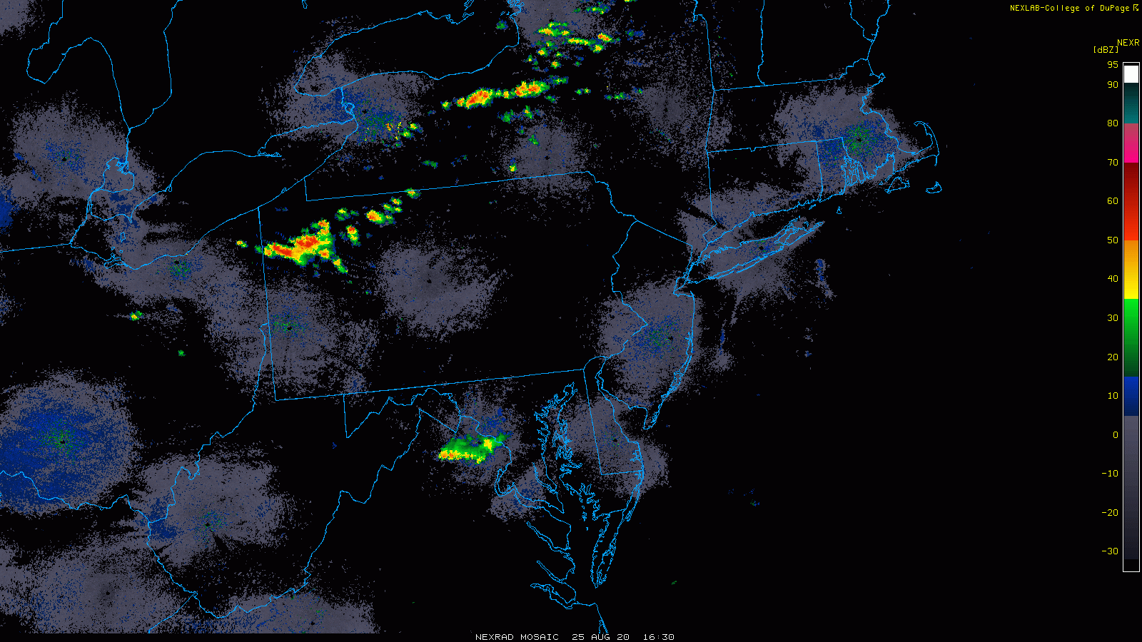
Thunderstorms have formed in the northwestern portion of the Mid-Atlantic and they’re charging to the southeast towards the I-95 corridor and into a very unstable air mass. Radar images courtesy NOAA (NEXRAD), College of DuPage
Overview
A cold front is pushing towards the DC-to-Philly-to-NYC corridor and it is going to generate thunderstorms in the region late today and early tonight and some of the storms can be severe with damaging wind gusts. A line of thunderstorms is now showing up on radar across northwestern portions of the Mid-Atlantic and these will likely strengthen and expand in coverage this afternoon as they move into increasingly unstable air. The most likely timetable for thunderstorm activity in the I-95 corridor is 6-10 PM.
Details
The atmosphere is quite unstable in the Mid-Atlantic region as we begin the afternoon as indicated by the “lifted index” stability parameter which when sharply negative suggests severe weather is a real threat. The cold front headed towards the I-95 corridor has supportive energy aloft and it will run into this very warm, moist and unstable air mass at the peak heating time of day. The threat for severe weather is likely highest south of the PA/MD border, but there certainly can be some severe weather activity across PA, New Jersey and southern New York. The most likely timetable for the thunderstorm activity in the I-95 corridor is 6-10 PM with the passage of the cold front likely in the overnight hours.

The “lifted index” is a stability parameter that provides information on the overall stability of the atmosphere. Large negative values of -4 or less are indicative of very unstable air and the mid-day readings feature values as low as -6 in much of the I-95 corridor. Map courtesy NOAA
Following the passage of the cold front, it’ll start off quiet on Wednesday and there will be more comfortable temperatures and humidity levels, but the chance for thunderstorms will increase later in the day as the front stalls out nearby. That same front will turn around by early Thursday and push to the north as a warm front and afternoon temperatures could spike into the 90’s in DC, Philly and New York City on Thursday afternoon.

The remnants of Hurricane Laura could impact the Mid-Atlantic region on Saturday as they get intertwined with a new frontal system and an incoming upper-level trough. Map courtesy WSI, Inc., ECMWF
Looking ahead, the remains of Hurricane Laura are likely to push northward into the south-central states at week’s end and then take a turn to east and into the Mid-Atlantic region on Saturday. At this point in time, the remnants of Hurricane Laura will get intertwined with a new frontal system and an incoming upper-level trough and the result could be some heavy rainfall and possible severe weather in at least parts of the Mid-Atlantic at the beginning of the upcoming weekend.
Meteorologist Paul Dorian
Perspecta, Inc.
perspectaweather.com
Follow us on Facebook, Twitter, YouTube