12:30 PM (Friday) | *It’s mid-April and there is accumulating snow now falling in two parts of the nation…cold pattern to continue next ten days or so across much of eastern 2/3rds of US*
Paul Dorian

Overview
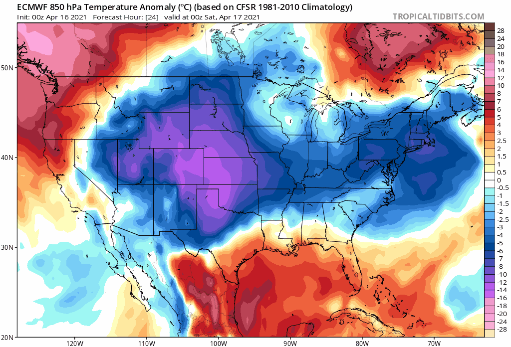
Late morning weather observations featured snow in Boston, Massachusetts at 35 degrees and snow in Denver, Colorado at 27 degrees – and yet it is the middle of April. In fact, there is accumulating snow in two parts of the nation at mid-day including much of New England which is being hit by a springtime nor’easter and also in the region from the central Rockies to the central Plains. Just when most people desire the sustained warmth that spring can offer this time of year, the overall weather pattern says not yet – at least not for much of the central and eastern US during the rest of the month of April. Not only is there a colder-than-normal air mass now extending across this large part of the country, it appears that there will be multiple cold air outbreaks for the central and eastern US during at least the next ten days or so. Winter is simply not going away without a fight.
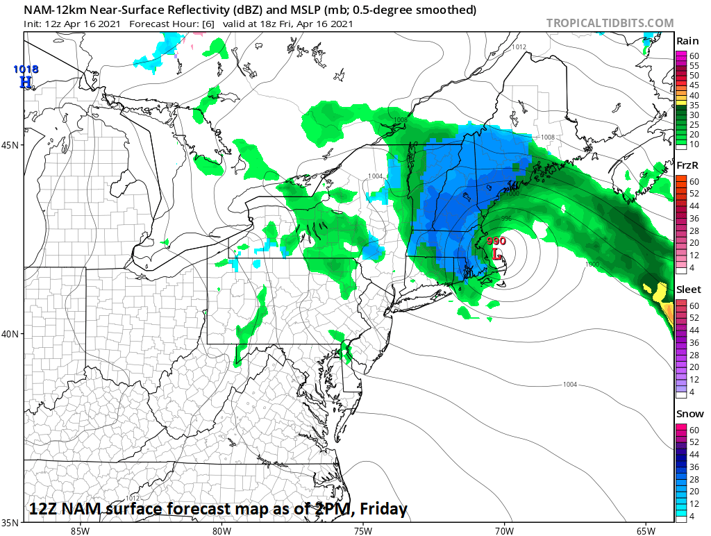
Accumulating snow across much of New England today; especially, focused on higher elevation locations from the Berkshires to the Green and White Mountains. Map courtesy NOAA, tropicaltidbits.com
Details
With accumulating snow now taking place in two separate parts of the nation as we begin the second half of April, it can be appropriately said that the country as a whole has endured a very long winter. One of the earliest snowstorms on record swept through parts of the United States, from Montana to New Mexico on September 8 and 9, 2020, bringing record-early snow and record cold to much of that region. And now comes this mid-April snow in the Northeast US and also in the region from the central Rockies to the central Plains.
A deep upper-level low pressure system has spun its way to the Northeast US coastline and it has helped to generate a springtime nor’easter which is pounding away in much of New England with accumulating snow; especially, in those higher elevation locations from the Berkshires of Massachusetts to the Green and White Mountains of Vermont and New Hampshire. This system is a slow mover thanks in part to blocking over the northeastern part of Canada and this snow event will continue through the day in this part of the nation. It is actually quite windy and cold all the way to the Philly-to-New York City corridor and don’t be surprised to see a few ice pellets or snowflakes mixed in with rain showers that have formed in this region.
Meanwhile, out in the western and central US, snow is falling from the central Rockies including in the Denver metro region to western sections of the central Plains (e.g., western Nebraska). There can be more snow shower activity this weekend in this part of the nation and then more accumulating snow is possible in the Rockies by late Monday or Monday night as another surge of cold air arrives.

Snow was reported at mid-day in Denver and it extends to western sections of the central Plains…this is not the last snow threat for this part of the nation in this cold weather pattern as we progress through the month of April. Map courtesy NOAA, tropicaltidbits.com
In terms of temperatures, today’s expansive colder-than-normal air mass that stretches from the Rockies to the eastern seaboard will most certainly not be the last this month. In fact, there are strong signs for multiple cold air outbreaks that will drop southeastward from Canada into the central and eastern states over the next ten days or so. In addition to another snow threat for the Rockies early next week, more snow will be possible across interior Northeast US and Great Lakes/Ohio Valley by the middle and latter parts of next week.
Hopefully, the month of May will turn out better.
Meteorologist Paul Dorian
Perspecta, Inc.
perspectaweather.com
Follow us on Facebook, Twitter, YouTube
Video discussion: