
11:00 AM | **Cold air outbreak sweeping across the nation on its way to the eastern states…numerous records to be set with this cold shot…additional cold outbreaks next couple of weeks**
Paul Dorian

Widespread colder-than-normal air will dominate the eastern 2/3rds of the nation by mid-week. Map courtesy ECMWF, BAMWX.com
Overview
A cold air mass is sweeping across the nation as we wind down the month of October and it will reach the eastern states shortly on the heels of a late day strong cold frontal passage. Record low temperatures have been set or threatened in many spots today all the way from California to the nation’s mid-section and numerous record lows are likely to be set with this cold air outbreak during the next few mornings. Looking ahead, many signs point to additional cold air outbreaks from Canada into the US during the next couple of weeks and snow may become an early season threat in many parts of the country where it hasn’t already fallen.
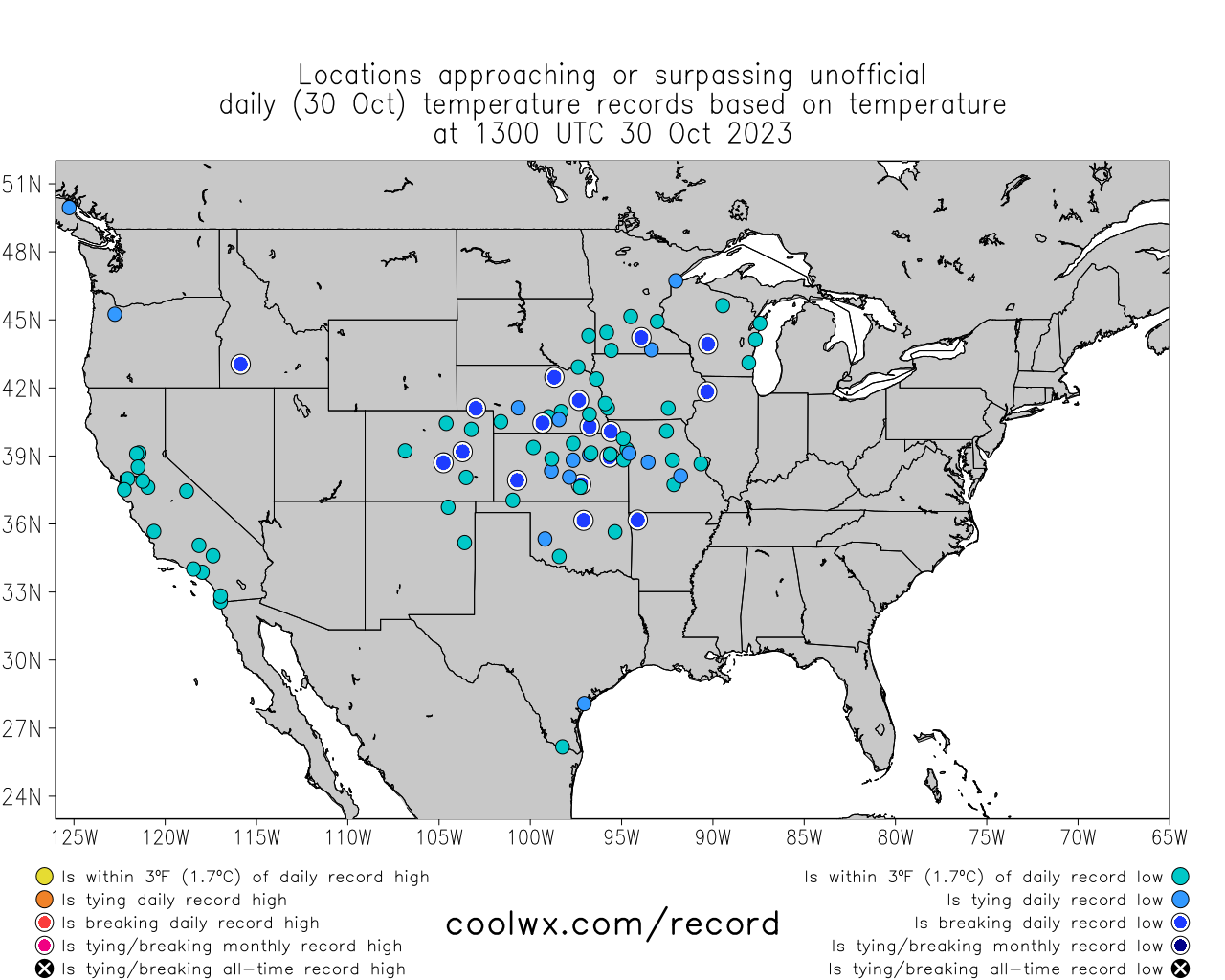
Numerous record lows were challenged today across the western half of the nation and many will be during each each of the next few mornings in the central and eastern US. Map courtesy coolwx.com, NOAA
Details
A cold air mass that had its origins in northern Canada has dropped temperatures to record or near record lows across many western and central states and has contributed to significant accumulating snow from the Rockies to the Northern Plains (e.g., 8 inches at Denver, CO, 13 inches at Glasgow, MT, 12 inches at Yellowstone, WY). This cold air outbreak has plunged all the way down into southern Texas and is now making its way into the eastern US and will be ushered in just in time for Halloween Day (Tuesday) in that part of the nation.

Quite an amazing chill today in the state of Texas where temperatures are some thirty degrees below normal for the latter stages of the month of October. Map courtesy Weather Bell Analytics, NOAA

There have been some record low temperatures set today across the western half of the nation and more are likely be set during each of the next few mornings across the central and eastern states. The “circled” stations on this map represent locations where record low temperatures can be set in this cold air outbreak. Map courtesy NOAA, weathermodels.com, BAMWX.com
Temperatures in the northern Mid-Atlantic region actually peaked at or slightly above the 80 degree mark on Saturday afternoon, but changes began to take place on Sunday across much of Pennsylvania with the passage of an initial cold frontal system. The southern Mid-Atlantic region continues to enjoy unseasonably warm conditions today as we begin the new work week, but a second cold front will soon usher in the coldest air mass of the season to the entire Mid-Atlantic region and Northeast US. The core of the cold air mass arrive in the Mid-Atlantic on Wednesday and temperatures by early Thursday morning could be below the freezing mark in a widespread area – the first such occurrence since last winter. It’ll remain colder-than-normal on Thursday and temperatures can again drop to or below the freezing mark by early Friday morning. Moderation in temperatures will take place this weekend in the Mid-Atlantic/Northeast US setting up for pretty decent weather for the first weekend of November.
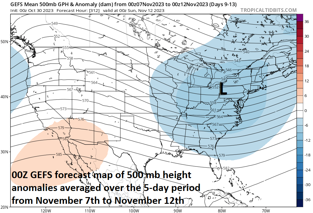
An upper-level trough of low pressure may develop in the eastern US in about ten days or so and this could result in additional well below-normal chill and perhaps even the threat for some early season snow in parts of the Mid-Atlantic/Northeast US where snow hasn’t already fallen. Map courtesy NOAA, tropicaltidbits.com
Looking ahead, there signs for additional cold air outbreaks as we push through next week and towards the middle of November. Some longer-range forecast models suggest deep upper-level trough of low pressure will develop in the eastern states in about ten days or so and this could even bring the threat for some early season snow to sections of the Mid-Atlantic/Northeast US where snow hasn’t yet fallen.
Meteorologist Paul Dorian
Arcfield
arcfieldweather.com
Follow us on Facebook, Twitter, YouTube
Video discussion: