8:30 AM | ****Incredible looking overall long-term pattern: afternoon/night accumulating snow with heavy squalls, damaging winds late tonight/early Sunday with possible power outages, painful cold on Sunday, multiple additional snow threats and brutal cold air outbreaks****
Paul Dorian
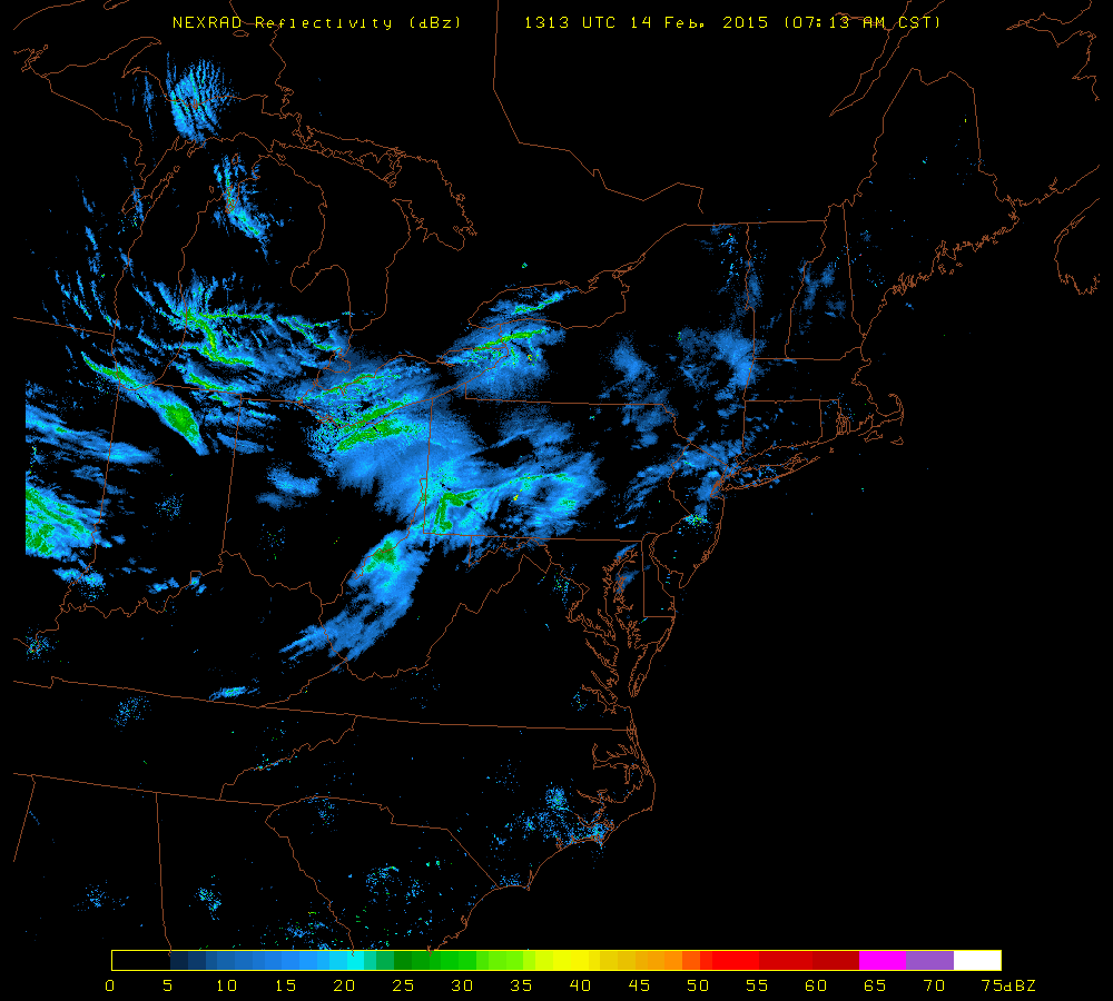 [Early morning NEXRAD radar image with snow over the Great Lakes/Ohio Valley and headed our way; image courtesy University of Wisconsin]
Discussion
The next 24-36 hours will bring us accumulating snow with heavy squalls, high impact winds, painful cold and dangerous sub-zero wind chills as a result of tremendous intensification of a storm system off the Northeast US coastline. This storm is currently located over southeastern Ontario and it will drop rapidly today towards the I-95 corridor region. Once this system reaches the coastal waters it will deepen explosively by some 36 millibars in a 24-hour period. The combination of the relatively warm waters of the western Atlantic Ocean, an extremely vigorous upper-level wave of energy, and a powerful upper-level jet streak will help cause this rapid intensification during the next 24 hours or so. This type of rapid and significant intensification will lead to a very sharp pressure gradient across the Northeast US which, in turn, will lead to extreme wind gusts on the order of 55 mph or so in the period between late tonight and Sunday morning (approximately 3 am to noon). Unfortunately, power outages are quite possible with this type of wind from late tonight into early which is the same time the coldest air of the season comes pouring into the region. Winds will slowly decrease later Sunday afternoon and evening.
As far as the snow is concerned, while there can be some snow seen this morning, the majority of the snow showers and possible heavier snow squalls should occur this afternoon and continue this evening. The snow part of this event will really consist of two parts: one part associated with the Arctic front from this afternoon into the late evening hours and then the second part associated with the developing storm late tonight and early Sunday. Some of the snow squalls this afternoon and evening can be quite intense with brief heavy snowfall, gusty winds, very poor visibility ("white out" conditions) and quick accumulations. Late tonight and early tomorrow will pose another chance for additional snowfall from eastern PA northeast across New Jersey and New York City as the storm deepens rapidly off the coastline. In fact, New York City could end up with its heaviest snowfall during this latter portion of the storm when an “inverted trough” extends to the northwest of the intensifying surface low pressure center. One final note on the snow, it is possible that some "thunder snow" occurs during the next 24 hour in portions of the I-95 corridor given this tremendous upper-level suport and upward motion in the atmosphere.
Accumulations by tomorrow morning are likely to be in the 1-3 inch range across Philly, a coating to 2 inches in the DC metro region, and 2-5 inches in and around NYC metro region. However, we'll have to watch for a potential surprise late tonight and early Sunday for additional snowfall in the Philly metro region and especially in the New York City metro region which could add to these preliminary accumulation estimates. Much of the snow that does accumulate will be whipped around by powerful winds late tonight and on Sunday with considerable blowing and drifting possible in some areas. Temperatures are likely to drop to single digits by early tomorrow throughout the I-95 corridor, then struggle to rise at all during the day, and then plunge to possible record-breaking territory by early Monday morning in the area of 0 degrees or even slightly below.
Another system could throw significant accumulating snow our way late Tuesday into early Wednesday, but that storm track is still somewhat uncertain. However, what is quite certain is that there will be more bitter cold air for the second half of next week and beyond and there will be multiple additional snow threats as an unbelievable long-term pattern is shaping up for the Mid-Atlantic region.