
11:00 AM | ***Powerful storm brings strong-to-severe thunderstorm threat to DC, Philly, New York City late today and early tonight***
Paul Dorian
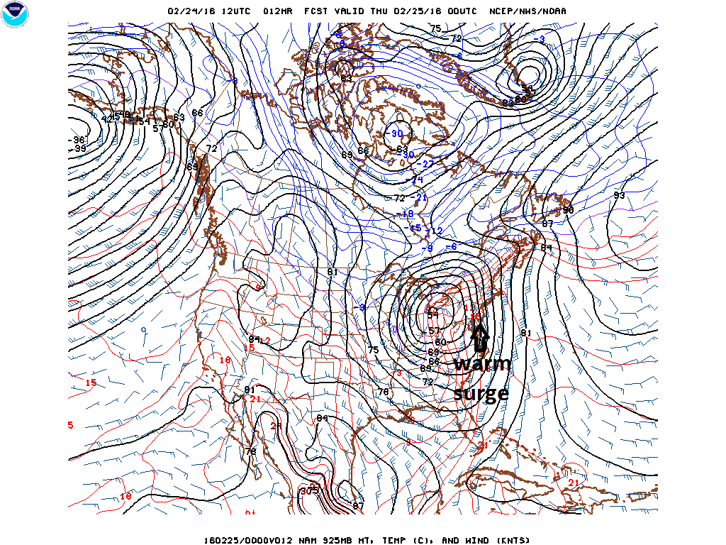
12Z NAM early evening forecast map of lower atmosphere temperatures with a warm surge along the Mid-Atlantic coastline
Numerous ingredients are coming together for thunderstorms to develop in the DC-to-Philly-to-NYC corridor late this afternoon and evening and some of these can reach strong-to-severe levels. Specifically, the ingredients coming together for potential severe weather in the I-95 corridor include the following:
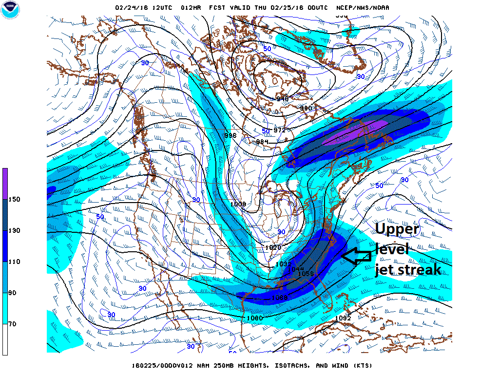
12Z NAM early evening forecast map of upper-level winds (at 250 mb)
1) Warm surge of air moving northward along the east coast destabilizes the atmosphere
2) Negatively tilted upper-level trough axis (i.e., from northwest-to-southeast) of low pressure which adds to upward motion
3) Strong upper-level jet streak which adds to upward motion
4) Very high bulk wind shear in low-to-middle atmosphere which adds to “supercell” and tornado threat
5) Tightening pressure gradient as surface low pressure rapidly intensifies over the Ohio Valley adds to damaging wind gust threat
6) High levels of moisture transport at 850 mb

12Z NAM early evening forecast map of upper-level low and trough axis (at 500 mb)
The greatest chance for severe thunderstorms will be across southeastern Virginia and eastern North Carolina later today/early tonight, but a serious threat for severe weather extends all the way up to the New York City metro region with the expected timetable of 4-10 PM in the DC-to-Philly-to-NYC corridor. Any storm late today/early tonight can include torrential downpours, damaging wind gusts of up to 60 mph, possible hail and even isolated tornadoes. Flash flooding is also a concern as grounds are saturated and downpours can cause quick ponding on roadways and streams and rivers to rise rapidly.

RAP model forecast of surface-to-500 millibar bulk wind shear; map courtesy TwisterData.com
Following the storm, colder air will ride in on strong NW winds later tomorrow and tomorrow night and there can be some snow shower activity to go along with those colder, windy conditions.

Moisture transport at 850 millibars (lower atmosphere) is very high (shown in light red)
Meteorologist Paul Dorian
Vencore, Inc.