
12:40 PM | **An accumulating snow event on the order of 1-3 inches from later tomorrow into Wednesday morning for DC, Philly, NYC**
Paul Dorian

12Z GFS forecast map of accumulated snow depth for the upcoming event; map courtesy NOAA/EMC, tropicaltidbits.com
Overview
An accumulating snow event is likely in the Mid-Atlantic region from later tomorrow into Wednesday and it should bring 1-3 inches of snow to the I-95 corridor region from DC-to-Philly-to-NYC. Cold air will stick around following this snow event for the latter part of the work week, but a noticeable warm up will take place this weekend.

12Z GFS forecast map for Tuesday evening with snow in blue; map courtesy NOAA/EMC, tropicaltidbits.com
Discussion
Upper-level energy will slide across the Midwest and into the eastern US during the next 36 hours and will contribute to the formation of low pressure near the Mid-Atlantic coastline by early Wednesday. Meanwhile, a cold front will also play an important role in this upcoming snow event as it will slow down as it arrives in the eastern US on Tuesday as it will become oriented parallel to the upper-level wind flow (southwest-to-northeast). As a result, snow associated with the frontal system will tend to last for an extended period of time tomorrow night and then low pressure induced snow will fall early Wednesday.
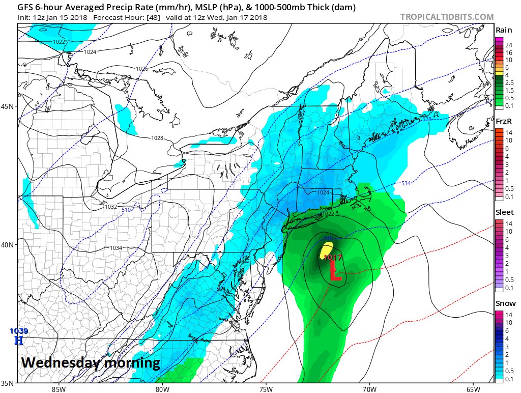
12Z GFS forecast map for Wednesday morning with snow in blue; map courtesy NOAA/EMC, tropicaltidbits.com
The combination of the front and low pressure system should throw accumulating snow into the DC-to-Philly-to-NYC corridor on the order of 1-3 inches. The timetable for the snow is primarily from early tomorrow night into Wednesday morning with some impact likely for the Wednesday AM commute. It'll stay cold following this system for the latter part of the work week with a reinforcing cold air mass ushered in by the frontal passage.
Weekend warm up
Noticeably milder weather is likely to return to the I-95 corridor for the upcoming weekend. Temperatures on Saturday are likely to reach the 40’s in most spots and then 50+ degrees is possible on Sunday making the Eagles playoff game considerably different weather-wise than last weekend.
Meteorologist Paul Dorian
Vencore, Inc.
vencoreweather.com
Video discussion: