
3:00 PM | ***Thunderstorm and heavy rain threat tonight into Thursday as Barry’s remains pass through the region…an atmospheric blow torch from Friday into Monday with 100 degrees on the table***
Paul Dorian

Showers and thunderstorms likely tomorrow night as a result of Barry’s remains pushing through; courtesy NOAA, tropicaltidbits.com
Overview
There are two big weather stories unfolding in the Mid-Atlantic region for the second half of the week and the upcoming weekend with the potential of some strong-to-severe thunderstorms and heavy rainfall over the next couple days as the remains of Barry pass through the region and then the hottest weather of the summer so far in the Friday into Monday time frame. Showers and thunderstorms are possible from tonight into Thursday in the DC-to-Philly-to-NYC corridor - any one of which can produce heavy rainfall. Once this large moisture field associated with Barry’s remnants pushes away from the area, an atmospheric blow torch will setup and cause temperatures to soar on Friday in the I-95 corridor and triple digits will be possible over the upcoming weekend. A strong cool front is likely to bring a round of showers and storms to the Mid-Atlantic late on Monday and more reasonable air is likely for the middle and latter parts of next week.
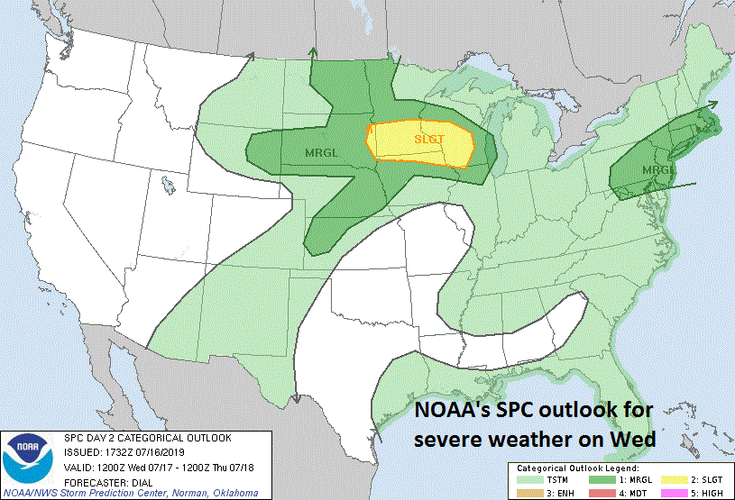
Thunderstorms late tomorrow/tomorrow night can reach strong-to-severe levels in the Mid-Atlantic region; courtesy NOAA
Mid-week heavy rain and strong storm threat with Barry’s remains
Barry came ashore early this weekend in central Louisiana as a weak (cat 1) hurricane and dumped lots of rain across the central Gulf coastal region. The winds were never really a factor down there, but the rainfall was certainly on the high side with some spots receiving more than a foot. The remains of Barry are now resulting heavy showers and thunderstorms in the Mississippi and Ohio Valleys and this area of moisture will continue to head towards the Mid-Atlantic region. Indeed, showers and thunderstorms will threaten the region tonight and will become even more widespread later tomorrow, tomorrow night and Thursday and some of the rain can be heavy at times - nothing new for this very wet long-standing weather pattern.
Now that Barry has pushed inland, the overall Atlantic Basin tropical scene is rather quiet. There remains quite a bit of dry (Saharan Dust) air over the tropical Atlantic Ocean and this will continue to inhibit “African-wave” tropical storm formation in the eastern Atlantic. Barry was a “home-grown” type of tropical system which formed close by over the warmer-than-normal waters of the Gulf of Mexico and it did not originate in the eastern Atlantic. One final note of interest, upwelling took place underneath Barry as it churned over the Gulf of Mexico during the weekend and this has brought cooler-than-normal waters to the surface which may inhibit tropical activity there for the next several days.

A major heat wave will be experienced this weekend in the Mid-Atlantic, NE US and Midwest; 850 temperature anomalies forecast map courtesy NOAA, tropicaltidbits.com
Excessive heat Friday into Monday
Once Barry’s moisture field pushes away from here later in the week, the door will be open for very hot air to move into the Mid-Atlantic region from the west and southwest. As a result, temperatures should soar to the mid and upper 90’s for highs on Friday in the DC-to-Philly-to-NYC corridor and the same temperature pattern is likely on Saturday, Sunday and Monday with triple digit highs on the table. There will be cooler-than-normal air pressing into the middle of the country early next week and this air mass is likely to bring an end here to this upcoming stretch of very hot weather.

Strong ridging aloft will contribute to excessive heat at the surface this weekend in the Mid-Atlantic, NE US and Midwest; 500 mb height anomalies forecast map courtesy NOAA, tropicaltidbits.com
In fact, showers and thunderstorms are likely later Monday associated with a strong cool front and this is likely to break the back of the heat wave. Longer term, there are signs for pretty comfortable weather conditions as we progress through the latter part of July and it could very well turn out that this stretch of excessive heat from Friday into Monday may just be the worst of the heat this summer in the Mid-Atlantic/NE US.

Cooler-than-normal air is destined to returned to the eastern third of the nation for the latter part of July; courtesy NOAA, tropicatidbits.com
Meteorologist Paul Dorian
Perspecta, Inc.
perspectaweather.com