
12:00 PM | ***Cold air mass to sweep across the nation next week…strong storm system likely to impact a large area of the country ahead of the Thanksgiving Day holiday***
Paul Dorian

A cold air mass originating in northern Canada will travel from northwest-to-southeast next week resulting in a cold Turkey Day (Thursday) for much of the nation. Map courtesy NOAA, tropicaltidbits.com
Overview
The overall weather pattern across the nation is becoming more and more active compared to recent days and it is likely to result in a strong storm system by the middle of next week that impacts a wide area from the Great Lakes and Midwest to the Mid-Atlantic and Northeast US. In terms of temperatures, the overall pattern will flip across the nation from today’s widespread warmer-than-normal conditions to below-normal for the last ten days or so of the month of November. In fact, a widespread cold air mass with its origins in northern Canada will sweep across the nation next week from northwest-to-southeast…just in time for the Thanksgiving Day holiday. This is very likely not going to be the last cold blast for the eastern half of the nation as the colder pattern that sets up next week will likely take us to the beginning of December.

A pattern flip across the nation will bring increasingly colder conditions to the eastern half of the nation by the second half of next week and a deep upper-level trough will set up shop over that part of the country. Map courtesy NOAA, tropicaltidbits.com
Details
The overall weather pattern has become more active in recent days with multiple systems now impacting different sections of the country. Low pressure formed over the Gulf of Mexico earlier in the week bringing significant rainfall to much of the northern Gulf region and a secondary system will soon form just to the east of Florida. This second storm will generate heavy rainfall over the next couple of days across the southern half of Florida (e.g., 4-8 inches likely for Miami and Fort Lauderdale) before it turns to the northeast moving over the western Atlantic Ocean.
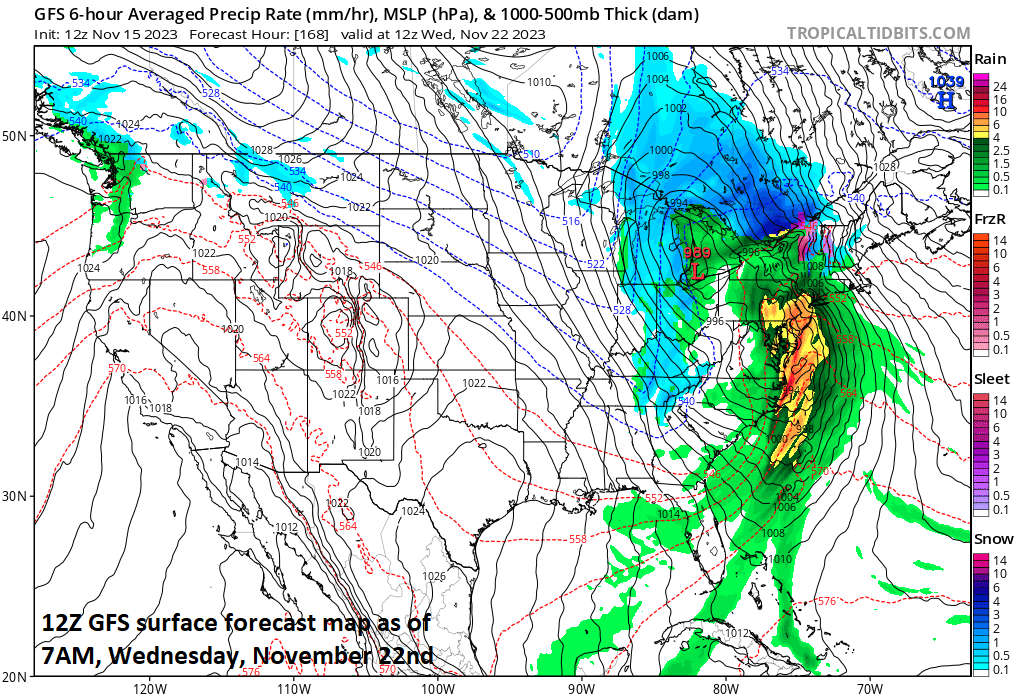
A powerful storm system appears destined to impact a large part of the nation from next Tuesday into Wednesday - just ahead of the Thanksgiving Day holiday. This storm system will impact the western states during the next few days and then push to the nation’s mid-section by early next week. Map courtesy NOAA, tropicaltidbits.com
Meanwhile, a lot of moisture is headed towards California from the eastern Pacific Ocean and this will result in rain and strong thunderstorms for coastal sections and accumulating snow in the higher elevations of the Sierra Nevada Mountains. By the late weekend/early next week, this Pacific storm system will work its way into the nation’s mid-section and low pressure is likely to intensify over the Upper Midwest by Tuesday of next week. This intensifying storm system may very well have an important impact next Tuesday and Wednesday (an important travel pre-holiday time period) in a large area of the US extending from the Midwest and Great Lakes to the Mid-Atlantic and Northeast. Rain is likely on the front side of the storm on Tuesday and Tuesday night in the Mid-Atlantic/Northeast US where intensifying southerly winds can bring in milder air and some of the rainfall can be heavy - a rarity in recent weeks. To the northwest of the strong surface low, cold air may result in accumulating snow to go along with strong N-NW winds in the Great Lakes region and ultimately, accumulating snow may fall across some interior higher-elevation locations of the Northeast US.
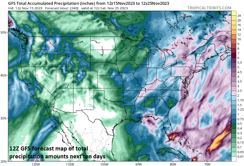
A more active weather pattern across the nation will result in copious amounts of precipitation during the next ten days including in the western US, Gulf of Mexico region, and the Mid-Atlantic/Northeast US. Map courtesy NOAA, tropicaltidbits.com
By the time we get to Thanksgiving Day on Thursday, November 23rd, the strong storm system is likely to have moved to northern New England or southeastern Canada and the cold air outbreak will penetrate into the Mid-Atlantic/Northeast US making for a cold Turkey Day across much of the nation. Additional cold air outbreaks are likely to follow for the eastern half of the nation as we progress through the remainder of the month of November.
Meteorologist Paul Dorian
Arcfield
arcfieldweather.com
Follow us on Facebook, Twitter, YouTube
Video discussion: