
12:40 PM | *More snow coming on Friday…more on the record cold...and a temporary break in the cold*
Paul Dorian

Numerous low temperature records were broken this morning from the Northern Plains to the east coast and, in a few places, all-time record low temperatures were set. Map courtesy coolwx.com
Overview
Clouds will increase late tonight ahead of a quick-moving low pressure system and there can be a minor snow event on Friday in the DC-to-Philly corridor. This system is a fast-mover with limited upper-level support and moisture so it should not be a significant snow producer - perhaps a coating to an inch or two - but still need to watch for slick spots with the frigid cold ground-level air temperatures. The weekend will begin a warming trend that will peak in the Monday/Tuesday/Wednesday time period of next week, but cold weather will make a return by the end of next week. Elsewhere, the record-breaking cold across the Upper Midwest will ease after today, but more all-time record lows were set this morning.
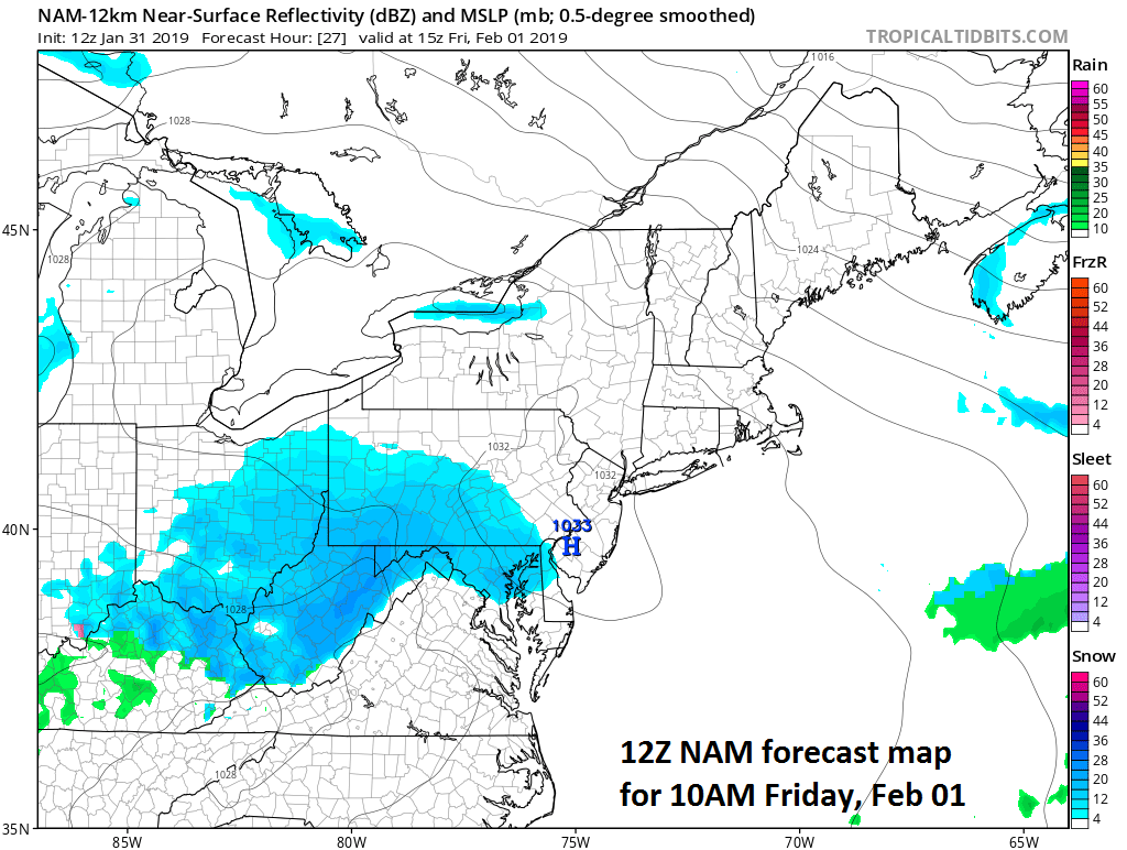
A bit of snow on Friday in the Mid-Atlantic region as depicted by the 12Z NAM (at 10am); courtesy NOAA/EMC, tropicaltidbits.com
Friday minor snow event
The bitter cold air of today will transition to a milder air mass this weekend and that transition will include some snow as low pressure moves quickly in a west-to-east fashion. The snow will be more significant across the Ohio Valley late tonight and Friday and some higher elevation spots in West Virginia could see several inches. The system will tend to weaken some, however, as it moves into the Mid-Atlantic region on Friday and any accumulation is likely to be minor on the order of a coating to an inch or two. The area most likely to get the snow is the corridor from DC-to-Philly with New York City likely too far north. The snow may start in the early-to-mid morning hours in the DC metro region and late morning/mid-day in Philly and it should wind down during the afternoon. One final note of caution, although this will be a relatively minor snow event, ground-level temperatures have been very cold recently so any snow will likely stick quite quickly on all untreated surfaces and even treated surfaces as salt is less effective.
A break in the cold for the Mid-Atlantic
A warming trend will begin this weekend in the Mid-Atlantic region with 30’s possible for highs on Saturday and 40’s on Sunday. By Monday, high temperatures should reach the 50’s in the DC-to-Philly-to-NYC corridor and those above-normal temperatures will continue through mid-week. On Thursday, a cold front will be approaching from the northwest and its eventual passage will usher in a return to cold weather by the end of next week.

Numerous low temperature records have been set in the eastern US during the past couple of mornings; courtesy NOAA/NWS
Record cold
Numerous daily, monthly low temperature records were set again this morning in the Upper Midwest and there were at least three all-time low temperature records: 1) Moline, IL at -33°F, Rockford, IL at -30°F and Volk, WI at -35°F. Chicago, Illinois did not break their all-time record low of -27°F set in January 1985, but it came within three degrees on Wednesday morning by bottoming out at -24°F. The official low temperature this morning at Chicago was -21°F. This shatters the previous record for Jan 31st, which was -12°F set back 1985. In records that date back to the 1870’s, this is only the 15th time Chicago has seen a daily low this cold or colder, yesterday was 14th.

At 7 AM (EST), temperatures bottomed out across the Lower 48 with 84 million people at/below 0°F. Map courtesy weathermodels.com, Dr. Ryan Maue
The state of Illinois may have set their all-time low temperature record as the Mt. Carroll coop site reported a low of -38°F this morning. The all-time record low for the state of Illinois is (or was) -36°F set in Congerville on January 5, 1999. The state of Minnesota came very close to their all-time low temperature record with a low of -56°F in Cotton. This fell 4 degrees short of matching the all-time low for the state of -60°F set in 1996. The bitter cold will ease in the Upper Midwest after today. In the eastern US, many records were set on Wednesday and Thursday and the table (above) has a listing of some of those confirmed by the National Weather Service.
Meteorologist Paul Dorian
Perspecta, Inc.
perspectaweather.com
Video discussion: